
| Prel. Rep. | Date | Time(UTC) | Time(Local) | Lat. | Lon. | Depth | Mag. | Region | Waveform |
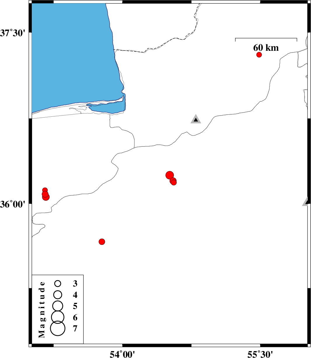
| 2016/01/16 | 06:37:31.0 | 10:07:31.0 | 36.187 | 54.558 | 18 | ML:2.7 | Semnan Province, 19 km -East of Damghan | ||
| 2016/01/16 | 06:24:00.1 | 09:54:00.1 | 36.201 | 54.55 | 14 | ML:3.3 | Semnan Province, 18 km -East of Damghan | ||
| 2016/01/16 | 05:31:15.2 | 09:01:15.2 | 36.251 | 54.514 | 17 | ML:3.9 | Semnan Province, 18 km -East of Damghan | ||
| 2015/12/29 | 21:24:46.5 | 00:54:46.5 | 35.663 | 53.776 | 14 | ML:2.9 | Semnan Province, 36 km -East of Semnan | ||
| 2015/12/28 | 12:33:40.3 | 16:03:40.3 | 37.306 | 55.487 | 18 | ML:2.5 | Golestan Province, 8 km of Kalaleh | ||
| 2015/12/27 | 11:32:21.7 | 15:02:21.7 | 35.274 | 53.175 | 14 | ML:3.9 | Semnan Province, 38 km South-West of Semnan | ||
| 2015/12/22 | 22:21:37.3 | 01:51:37.3 | 36.084 | 53.159 | 14 | ML:3.1 | Mazandaran Province, 10 km -East of Pol-E-Sefid | ||
| 2015/12/22 | 07:08:04.6 | 10:38:04.6 | 36.06 | 53.167 | 15 | ML:3.5 | Mazandaran Province, 12 km -East of Pol-E-Sefid | ||
| 2015/12/21 | 22:36:39.5 | 02:06:39.5 | 36.119 | 53.157 | 15 | ML:2.5 | Mazandaran Province, 9 km -East of Pol-E-Sefid |