
| Prel. Rep. | Date | Time(UTC) | Time(Local) | Lat. | Lon. | Depth | Mag. | Region | Waveform |
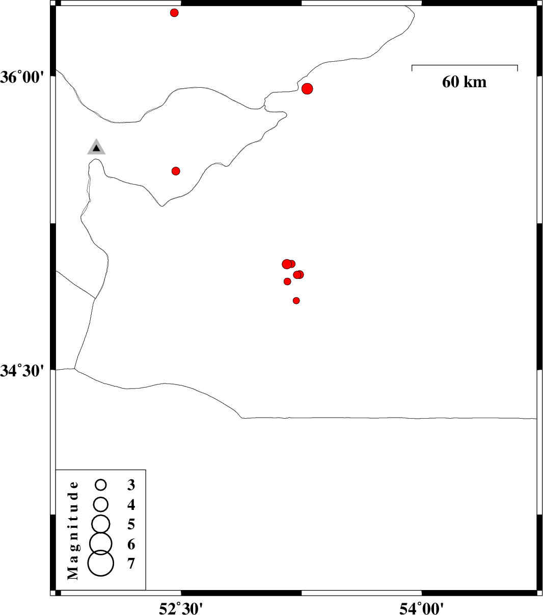
| 2015/09/30 | 19:32:27.5 | 23:02:27.5 | 34.855 | 53.217 | 14 | ML:1.8 | Semnan Province, 81 km South-West of Semnan | ||
| 2015/09/30 | 10:41:07.8 | 14:11:07.8 | 36.319 | 52.457 | 14 | ML:2.3 | Mazandaran Province, 19 km South-East of Amol | ||
| 2015/09/30 | 04:14:39.3 | 07:44:39.3 | 34.987 | 53.222 | 14 | ML:2.1 | Semnan Province, 66 km South-West of Semnan | ||
| 2015/09/29 | 14:09:55.8 | 17:39:55.8 | 34.953 | 53.162 | 15 | ML:2 | Semnan Province, 72 km South-West of Semnan | ||
| 2015/09/29 | 13:36:31.8 | 17:06:31.8 | 34.988 | 53.238 | 14 | ML:2.2 | Semnan Province, 66 km South-West of Semnan | ||
| 2015/09/29 | 06:45:04.8 | 10:15:04.8 | 35.042 | 53.159 | 14 | ML:2.7 | Semnan Province, 62 km South-West of Semnan | ||
| 2015/09/28 | 22:41:25.2 | 02:11:25.2 | 35.517 | 52.467 | 14 | ML:2.3 | Tehran Province, 35 km North-East of Garmsar | ||
| 2015/09/26 | 00:41:07.9 | 04:11:07.9 | 35.043 | 53.187 | 14 | ML:2.1 | Semnan Province, 61 km South-West of Semnan | ||
| 2015/09/25 | 21:22:48.3 | 00:52:48.3 | 35.935 | 53.285 | 14 | ML:3.1 | Semnan Province, 29 km South-East of Pol-E-Sefid |