| Prel. Rep. | Date | Time(UTC) | Time(Local) | Lat. | Lon. | Depth | Mag. | Region | Waveform |
|
|
2015/10/02
|
03:22:44.0
|
06:52:44.0
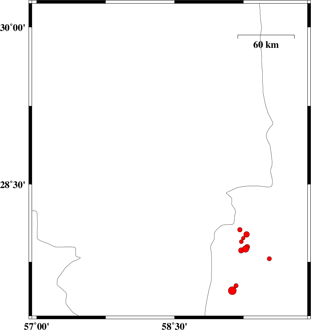
| 28.726 | 58.447 | 15 |
ML:2.7
|
Kerman Province, 43 km South of Bam | |
|
|
2015/09/27
|
08:29:29.9
|
11:59:29.9
| 28.26 | 57.547 | 15 |
ML:3.1
|
Kerman Province, 37 km North-West of Kahnuj | |
|
|
2015/09/27
|
05:24:13.3
|
08:54:13.3
| 28.344 | 57.515 | 14 |
ML:3.2
|
Kerman Province, 42 km South-West of Jiroft | |
|
|
2015/09/26
|
10:37:28.1
|
14:07:28.1
| 29.884 | 57.905 | 14 |
ML:2.1
|
Kerman Province, 97 km North-West of Bam | |
|
|
2015/09/24
|
12:05:56.9
|
15:35:56.9
| 29.147 | 59.81 | 14 |
ML:2.8
|
Sistan va Baloochestan Province, 110 km South-West of Zahedan | |
|
|
2015/09/22
|
00:33:13.1
|
04:03:13.1
| 29.977 | 57.645 | 18 |
ML:3.2
|
Kerman Province, 64 km South-East of Kerman | |
|
|
2015/09/20
|
01:52:47.4
|
06:22:47.4
| 30.158 | 57.584 | 14 |
ML:2.2
|
Kerman Province, 51 km South-East of Kerman | |
|
|
2015/09/19
|
22:23:49.5
|
02:53:49.5
| 27.852 | 57.404 | 18 |
ML:3.6
|
Hormozgan Province, 31 km -West of Kahnuj | |
|
|
2015/09/19
|
21:45:27.4
|
02:15:27.4
| 29.627 | 57.542 | 14 |
ML:2.1
|
Kerman Province, 86 km South-East of Kerman | |
|
|
2015/09/18
|
02:06:09.7
|
06:36:09.7
| 29.58 | 57.502 | 14 |
ML:4
|
Kerman Province, 89 km South-East of Kerman | |
|
|
2015/09/13
|
18:32:51.5
|
23:02:51.5
| 29.427 | 59.902 | 18 |
ML:2.7
|
Sistan va Baloochestan Province, 94 km -West of Zahedan | |
|
|
2015/09/11
|
15:39:39.6
|
20:09:39.6
| 30.114 | 57.657 | 14 |
ML:2.8
|
Kerman Province, 59 km South-East of Kerman | |
|
|
2015/09/11
|
00:55:47.6
|
05:25:47.6
| 30.078 | 57.62 | 14 |
ML:1.8
|
Kerman Province, 57 km South-East of Kerman | |
|
|
2015/09/10
|
07:35:06.8
|
12:05:06.8
| 29.996 | 57.663 | 18 |
ML:2.6
|
Kerman Province, 65 km South-East of Kerman | |
|
|
2015/09/10
|
04:56:13.5
|
09:26:13.5
| 30.046 | 57.599 | 18 |
ML:2
|
Kerman Province, 57 km South-East of Kerman | |
|
|
2015/09/08
|
01:18:28.8
|
05:48:28.8
| 28.601 | 57.197 | 14 |
ML:4
|
Kerman Province, 53 km -West of Jiroft | |
|
|
2015/09/04
|
15:32:31.5
|
20:02:31.5
| 29.963 | 57.598 | 15 |
ML:2.7
|
Kerman Province, 62 km South-East of Kerman | |
