
Magnitude |
:2.4 |
| Date & Time (UTC) | 2015-06-30 09:53:56.9 |
| Date & Time (Local) | 1394/4/9 14:23:56.9 |
| Location | Lat:31.71 Lon: 55.46 |
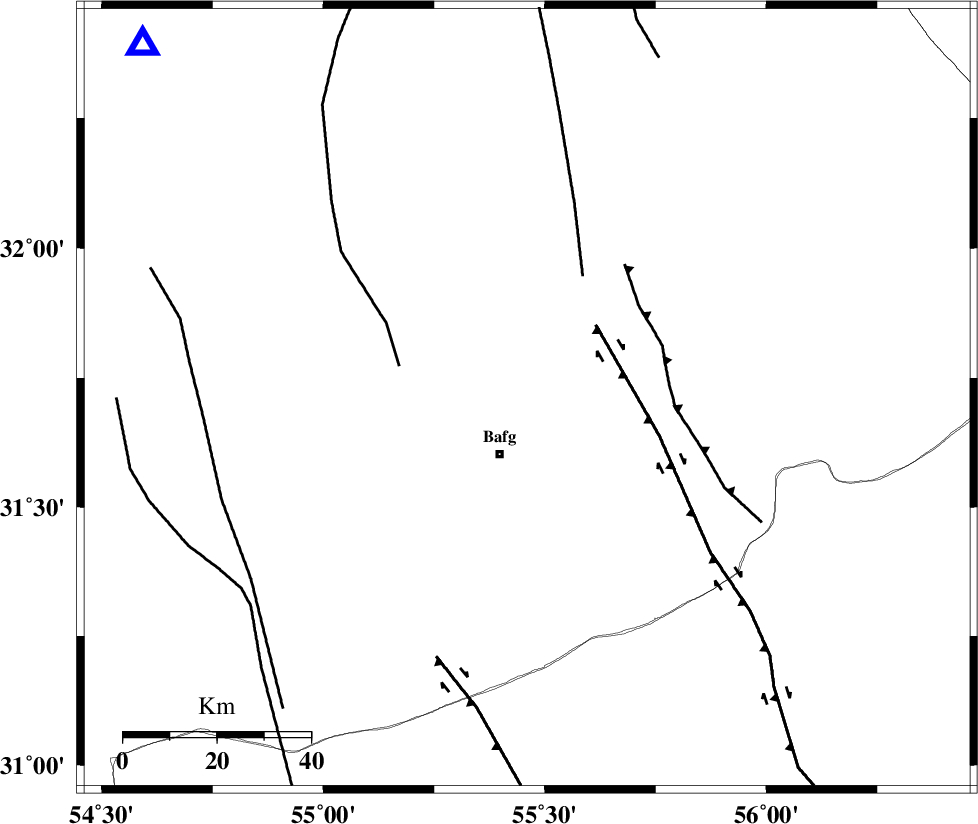
| Region | Yazd Province, 13 km North of Bafq |
Nearest Cities |
|
| 10 km North of Mobarake, Yazd Province | |
| 13 km North of Bafq, Yazd Province | |
| 31 km West of Kushk, Yazd Province | |
| 56 km North West of Basab, Yazd Province | |
| 56 km South West of Behabad, Yazd Province | |
| Depth | 6 km |
| Agency | |
Faults within 150 km: |
|
| POSHT_E_BADAM_F (Length: 128 km) , Distance to epicenter: 27 km | |
| DARIVAN_F (Length: 131 km) , Distance to epicenter: 36 km | |
| ANAR_F (Length: 91 km) , Distance to epicenter: 40 km | |
| Number of Phases | 4 |
| RMS | 0.2 |
| Number of Stations | 4 |
| Error in Latitude | >3.9 km |
| Error in Longitude | 4.7 km |
| Error in Depth | 7.5 km |
Download waveform in seisan format
to download seisan software Click here
to access information about IIEES stations Click here
Amplitude | ||||||||
| UID | Agency | Station | Component | Amplitude | Period | Arrival Time | Proccessing Time | Signal Clip |
| 96083 | IIEES | KRBR | N | 26.3 | 0.62 | 2015-06-30 09:55:05 | 2015-06-30 11:41:00 | n |
Phase | ||||||||||||
| Agency | Station | Component | Phase Type | Phase Quality | First Motion | Observed Arrival Time | Time Residual | Loc. Flag | Input Weight | Distance | Azimuth | |
| IIEES | YZKH | Z | Pg | E | 2015-06-30 09:54:16 | -0.25 | y | 111 | 313 | |||
| IIEES | KRBR | Z | Pn | E | 2015-06-30 09:54:34 | -0.08 | y | 229 | 147 | |||
| IIEES | TABS | Z | P | E | 2015-06-30 09:54:38 | 0.06 | y | 266 | 36 | |||
| IIEES | NASN | Z | Pn | E | 2015-06-30 09:54:40 | 0.28 | y | 277 | 297 | |||