
Magnitude |
:2.5 |
| Date & Time (UTC) | 2015-06-29 14:55:09.8 |
| Date & Time (Local) | 1394/4/8 19:25:09.8 |
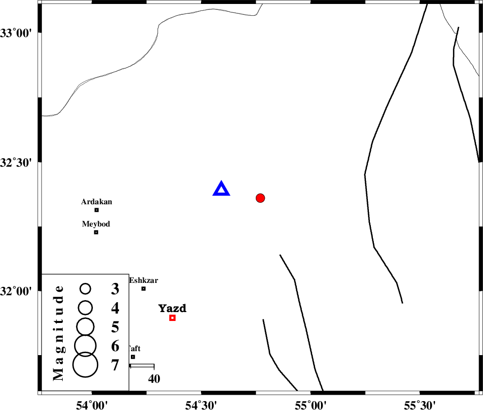
| Location | Lat:32.36 Lon: 54.77 |
| Region | Yazd Province, 70 km East of Ardakan |
Nearest Cities |
|
| 10 km North East of Kharaneq, Yazd Province | |
| 39 km South East of Tut, Yazd Province | |
| 47 km South of Zarrin, Yazd Province | |
| 64 km North East of Ashkezar, Yazd Province | |
| 64 km North East of Yazd, Yazd Province | |
| Depth | 6 km |
| Agency | |
Faults within 150 km: |
|
| ANAR_F (Length: 91 km) , Distance to epicenter: 26 km | |
| POSHT_E_BADAM_F (Length: 128 km) , Distance to epicenter: 46 km | |
| ANAR_F (Length: 127 km) , Distance to epicenter: 52 km | |
| Number of Phases | 6 |
| RMS | 0.1 |
| Number of Stations | 6 |
| Error in Latitude | >2.2 km |
| Error in Longitude | 5.3 km |
| Error in Depth | 8.2 km |
Download waveform in seisan format
to download seisan software Click here
to access information about IIEES stations Click here
Amplitude | ||||||||
| UID | Agency | Station | Component | Amplitude | Period | Arrival Time | Proccessing Time | Signal Clip |
| 96072 | IIEES | NASN | N | 52.8 | 0.33 | 2015-06-29 14:56:07 | 2015-06-30 06:14:00 | n |
| 96073 | IIEES | NASN | E | 54.3 | 0.36 | 2015-06-29 14:56:10 | 2015-06-30 06:14:00 | n |
| 96074 | IIEES | KRBR | N | 15.2 | 0.34 | 2015-06-29 14:56:41 | 2015-06-30 06:14:00 | n |
Phase | ||||||||||||
| Agency | Station | Component | Phase Type | Phase Quality | First Motion | Observed Arrival Time | Time Residual | Loc. Flag | Input Weight | Distance | Azimuth | |
| IIEES | YZKH | Z | Pg | E | 2015-06-29 14:55:13 | -0.08 | y | 16.9 | 281 | |||
| IIEES | NASN | Z | Pg | E | 2015-06-29 14:55:42 | 0.05 | y | 190 | 285 | |||
| IIEES | TABS | Z | Pn | E | 2015-06-29 14:55:50 | -0.05 | y | 262 | 56 | |||
| IIEES | KRBR | Z | Pn | E | 2015-06-29 14:55:59 | 0.06 | y | 325 | 144 | |||
| IIEES | BSRN | Z | Pn | E | 2015-06-29 14:56:09 | -0.05 | y | 413 | 95 | |||
| IIEES | SHRO | Z | Pn | E | 2015-06-29 14:56:10 | 0.09 | y | 421 | 15 | |||