
Magnitude |
:2.7 |
| Date & Time (UTC) | 2015-06-21 02:44:32.6 |
| Date & Time (Local) | 1394/3/31 07:14:32.6 |
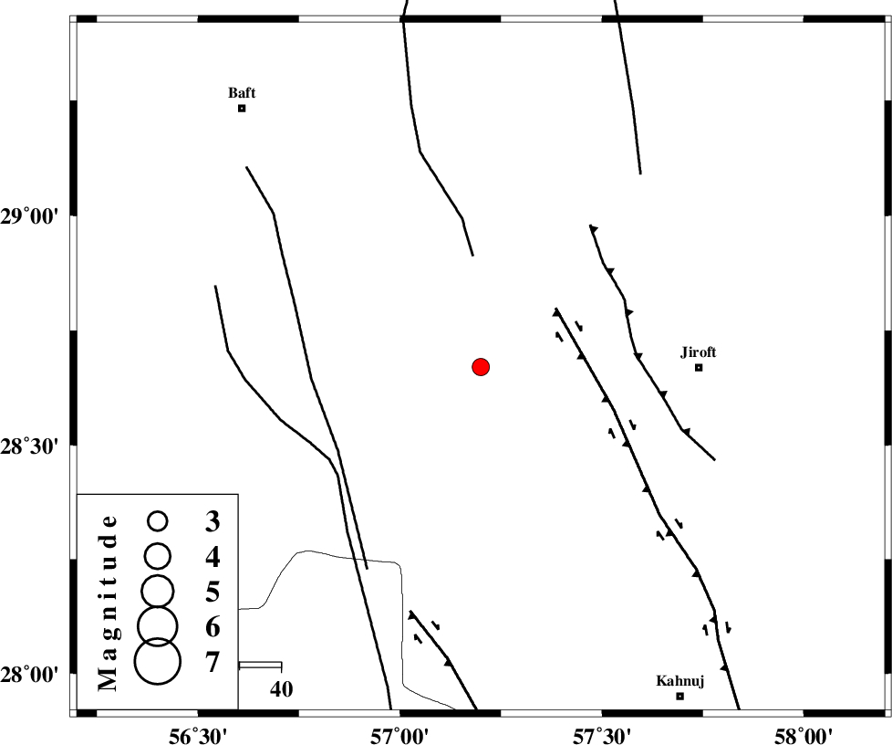
| Location | Lat:28.67 Lon: 57.2 |
| Region | Kerman Province, 53 km West of Jiroft |
Nearest Cities |
|
| 13 km East of Dolatabad, Kerman Province | |
| 40 km South West of Eslamabad, Kerman Province | |
| 48 km North East of Sarkhan, Kerman Province | |
| 50 km North West of Khatunabad-e zangian, Kerman Province | |
| 53 km North West of Jiroft, Kerman Province | |
| Depth | 14 km |
| Agency | |
Faults within 150 km: |
|
| SABZEVARAN_F (Length: 190 km) , Distance to epicenter: 50 km | |
| MAIN_ZAGROS_R_F (Length: 1106 km) , Distance to epicenter: 81 km | |
| GOWK_F (Length: 152 km) , Distance to epicenter: 82 km | |
| Number of Phases | 5 |
| RMS | 0.1 |
| Number of Stations | 3 |
| Error in Latitude | >1.5 km |
| Error in Longitude | 3.3 km |
| Error in Depth | 5.6 km |
Download waveform in seisan format
to download seisan software Click here
to access information about IIEES stations Click here
Amplitude | ||||||||
| UID | Agency | Station | Component | Amplitude | Period | Arrival Time | Proccessing Time | Signal Clip |
| 96003 | IIEES | KRBR | E | 113.5 | 0.15 | 2015-06-21 02:45:17 | 2015-06-21 04:07:00 | n |
| 96004 | IIEES | KRBR | N | 122.4 | 0.18 | 2015-06-21 02:45:18 | 2015-06-21 04:07:00 | n |
Phase | ||||||||||||
| Agency | Station | Component | Phase Type | Phase Quality | First Motion | Observed Arrival Time | Time Residual | Loc. Flag | Input Weight | Distance | Azimuth | |
| IIEES | KRBR | Z | Pg | E | 2015-06-21 02:44:57 | -0.19 | y | 151 | 344 | |||
| IIEES | KRBR | E | Sg | E | 2015-06-21 02:45:16 | 0.1 | y | 151 | 344 | |||
| IIEES | BNDS | Z | Pg | E | 2015-06-21 02:45:01 | 0.04 | y | 173 | 216 | |||
| IIEES | BSRN | Z | Pn | E | 2015-06-21 02:45:31 | 0.04 | y | 410 | 26 | |||
| IIEES | BSRN | E | Sg | E | 2015-06-21 02:46:27 | 0.01 | y | 410 | 26 | |||