
Magnitude |
:2.7 |
| Date & Time (UTC) | 2015-06-20 13:26:47.2 |
| Date & Time (Local) | 1394/3/30 17:56:47.2 |
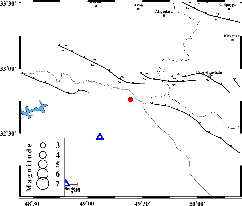
| Location | Lat:32.76 Lon: 49.39 |
| Region | Khoozestan Province, 49 km North-East of Lali |
Nearest Cities |
|
| 18 km South of Parchal, Lorestan Province | |
| 45 km West of Masir, Esfahan Province | |
| 45 km North West of Durak, Chaharmahal Bakhtiari Province | |
| 49 km North East of Lali, Khoozestan Province | |
| 52 km South East of Shulabad, Lorestan Province | |
| Depth | 14 km |
| Agency | |
Faults within 150 km: |
|
| ZARDKUH_F (Length: 139 km) , Distance to epicenter: 16 km | |
| HZF4 (Length: 492 km) , Distance to epicenter: 16 km | |
| MFF2 (Length: 205 km) , Distance to epicenter: 30 km | |
| Number of Phases | 5 |
| RMS | 0.1 |
| Number of Stations | 4 |
| Error in Latitude | >2.1 km |
| Error in Longitude | 3.9 km |
| Error in Depth | 4.4 km |
Download waveform in seisan format
to download seisan software Click here
to access information about IIEES stations Click here
Amplitude | ||||||||
| UID | Agency | Station | Component | Amplitude | Period | Arrival Time | Proccessing Time | Signal Clip |
| 95996 | IIEES | SHGR | N | 341.3 | 0.24 | 2015-06-20 13:27:18 | 2015-06-20 02:46:00 | n |
| 95997 | IIEES | SHGR | E | 218.6 | 0.48 | 2015-06-20 13:27:19 | 2015-06-20 02:46:00 | n |
Phase | ||||||||||||
| Agency | Station | Component | Phase Type | Phase Quality | First Motion | Observed Arrival Time | Time Residual | Loc. Flag | Input Weight | Distance | Azimuth | |
| IIEES | SHGR | Z | Pg | E | 2015-06-20 13:27:02 | 0.12 | y | 90.9 | 218 | |||
| IIEES | SHGR | N | Sg | E | 2015-06-20 13:27:13 | -0.09 | y | 90.9 | 218 | |||
| IIEES | KHMZ | Z | Pg | E | 2015-06-20 13:27:07 | -0.03 | y | 121 | 26 | |||
| IIEES | ASAO | Z | Pn | E | 2015-06-20 13:27:20 | 0.01 | y | 207 | 16 | |||
| IIEES | NASN | Z | Pn | E | 2015-06-20 13:27:34 | -0.01 | y | 320 | 88 | |||