
Magnitude |
:3.8 |
| Date & Time (UTC) | 2015-06-20 12:38:02.4 |
| Date & Time (Local) | 1394/3/30 17:08:02.4 |
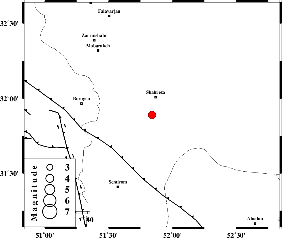
| Location | Lat:31.89 Lon: 51.84 |
| Region | Esfahan Province, 14 km South of Shahreza |
Nearest Cities |
|
| 11 km East of Musaabad, Esfahan Province | |
| 14 km South of Shahreza, Esfahan Province | |
| 19 km East of Dahaqan, Esfahan Province | |
| 20 km North of Kahruyeh, Esfahan Province | |
| 26 km North of Esfarjan, Esfahan Province | |
| Depth | 14 km |
| Agency | |
Faults within 150 km: |
|
| MAIN_ZAGROS_R_F (Length: 1106 km) , Distance to epicenter: 38 km | |
| DENA_F (Length: 137 km) , Distance to epicenter: 67 km | |
| DOPOLAN_F (Length: 107 km) , Distance to epicenter: 68 km | |
| Number of Phases | 6 |
| RMS | 0.2 |
| Number of Stations | 5 |
| Error in Latitude | >4.9 km |
| Error in Longitude | 5.9 km |
| Error in Depth | 10.2 km |
Download waveform in seisan format
to download seisan software Click here
to access information about IIEES stations Click here
Amplitude | ||||||||
| UID | Agency | Station | Component | Amplitude | Period | Arrival Time | Proccessing Time | Signal Clip |
| 95995 | IIEES | SHGR | N | 380.1 | 0.76 | 2015-06-20 12:39:40 | 2015-06-20 02:07:00 | n |
Phase | ||||||||||||
| Agency | Station | Component | Phase Type | Phase Quality | First Motion | Observed Arrival Time | Time Residual | Loc. Flag | Input Weight | Distance | Azimuth | |
| IIEES | NASN | Z | Pg | E | 2015-06-20 12:38:25 | -0.12 | y | 136 | 42 | |||
| IIEES | KHMZ | Z | Pn | E | 2015-06-20 12:38:43 | 0.05 | y | 271 | 320 | |||
| IIEES | SHGR | Z | Pn | E | 2015-06-20 12:38:45 | -0.28 | y | 289 | 276 | |||
| IIEES | GHVR | Z | Pn | E | 2015-06-20 12:38:46 | 0.18 | y | 293 | 349 | |||
| IIEES | GHVR | N | Sg | E | 2015-06-20 12:39:24 | -0.17 | y | 293 | 349 | |||
| IIEES | ASAO | Z | Pn | E | 2015-06-20 12:38:53 | 0.38 | y | 340 | 331 | |||