
Magnitude |
:2.3 |
| Date & Time (UTC) | 2015-06-18 03:32:06.7 |
| Date & Time (Local) | 1394/3/28 08:02:06.7 |
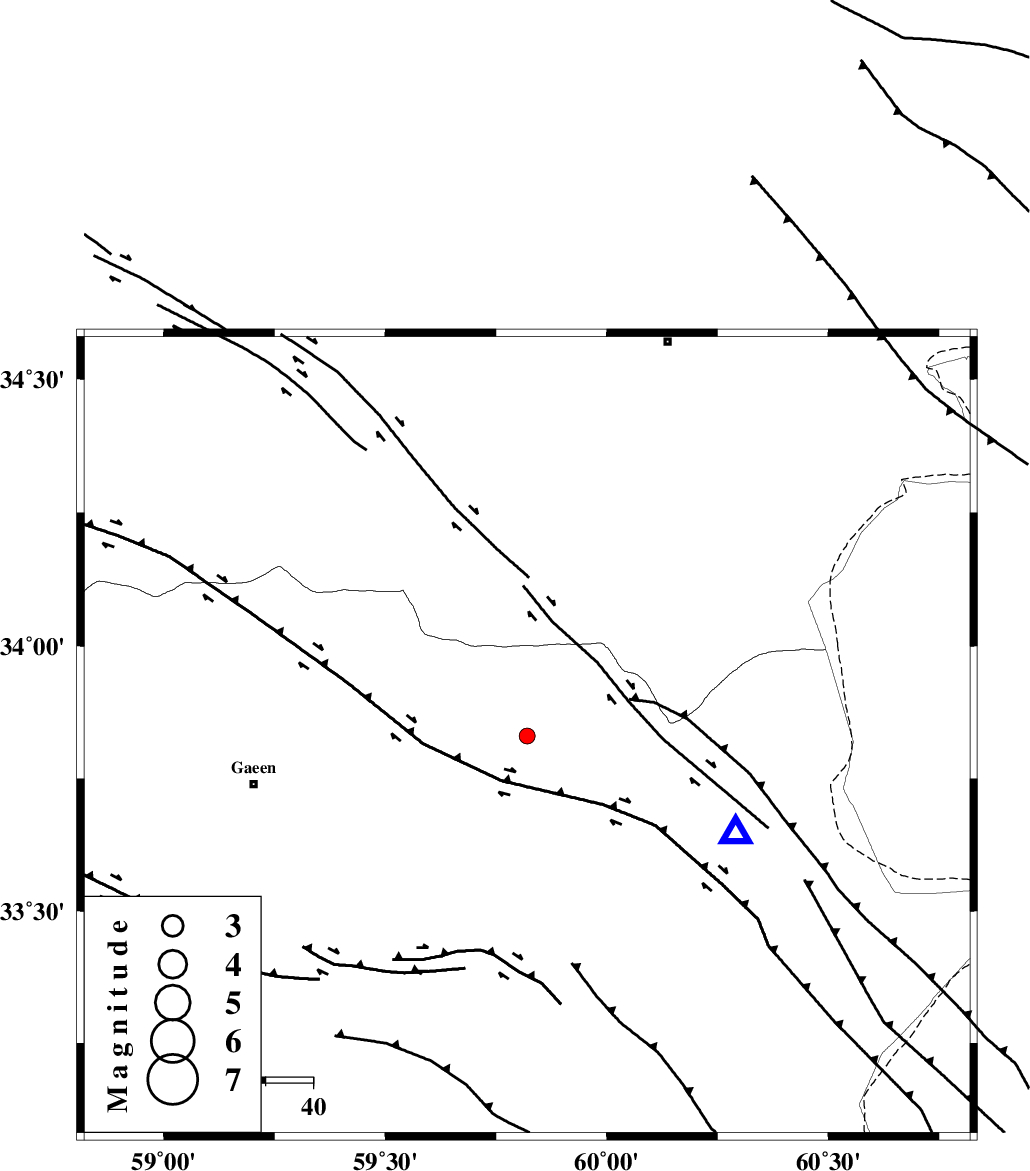
| Location | Lat:33.83 Lon: 59.82 |
| Region | 58 km East of Qaen |
Nearest Cities |
|
| 20 km North West of Abiz, Khorasan(south) Province | |
| 28 km North of Hajiabad, Khorasan(south) Province | |
| 38 km North West of Shahdokht, Khorasan(south) Province | |
| 46 km South West of Pasgah-e chazul, Khorasan(center) Province | |
| 47 km North of Zahan, Khorasan(south) Province | |
| Depth | 14 km |
| Agency | |
Faults within 150 km: |
|
| ABRIZ_F (Length: 114 km) , Distance to epicenter: 5 km | |
| DASHT_E_BAYAZ_F (Length: 177 km) , Distance to epicenter: 29 km | |
| JANGAL_F (Length: 111 km) , Distance to epicenter: 72 km | |
| Number of Phases | 4 |
| RMS | 0.2 |
| Number of Stations | 3 |
| Error in Latitude | >9.5 km |
| Error in Longitude | 3.2 km |
| Error in Depth | 7 km |
Download waveform in seisan format
to download seisan software Click here
to access information about IIEES stations Click here
Amplitude | ||||||||
| UID | Agency | Station | Component | Amplitude | Period | Arrival Time | Proccessing Time | Signal Clip |
| 95975 | IIEES | SHRT | E | 246.1 | 0.2 | 2015-06-18 03:32:25 | 2015-06-18 05:30:00 | n |
Phase | ||||||||||||
| Agency | Station | Component | Phase Type | Phase Quality | First Motion | Observed Arrival Time | Time Residual | Loc. Flag | Input Weight | Distance | Azimuth | |
| IIEES | SHRT | Z | Pg | E | 2015-06-18 03:32:15 | -0.18 | y | 48.5 | 115 | |||
| IIEES | BSRN | Z | Pn | E | 2015-06-18 03:32:41 | 0.11 | y | 217 | 198 | |||
| IIEES | TABS | N | Pn | E | 2015-06-18 03:32:45 | 0.34 | y | 251 | 266 | |||
| IIEES | TABS | N | Sg | E | 2015-06-18 03:33:17 | -0.27 | y | 251 | 266 | |||