
Magnitude |
:2.5 |
| Date & Time (UTC) | 2015-06-15 22:40:45.9 |
| Date & Time (Local) | 1394/3/26 03:10:45.9 |
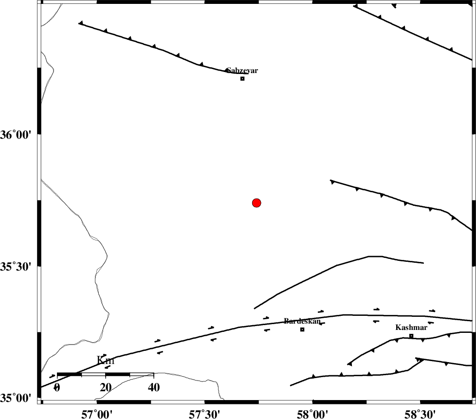
| Location | Lat:35.74 Lon: 57.74 |
| Region | Khorasan(center) Province, 52 km South of Sabzevar |
Nearest Cities |
|
| 8 km of Tondak, Khorasan(center) Province | |
| 13 km East of Bejdan, Khorasan(center) Province | |
| 24 km South of Sheshtamad, Khorasan(center) Province | |
| 37 km North West of Ghaleh meidan, Khorasan(center) Province | |
| 46 km North West of Kabudan, Khorasan(center) Province | |
| Depth | 16 km |
| Agency | |
Faults within 150 km: |
|
| BALHAR_F (Length: 117 km) , Distance to epicenter: 32 km | |
| BIJVARD_F (Length: 83 km) , Distance to epicenter: 38 km | |
| DORUNEH_F (Length: 713 km) , Distance to epicenter: 51 km | |
| Number of Phases | 5 |
| RMS | 0 |
| Number of Stations | 3 |
| Error in Latitude | >1.9 km |
| Error in Longitude | 4.8 km |
| Error in Depth | 5.9 km |
Download waveform in seisan format
to download seisan software Click here
to access information about IIEES stations Click here
Amplitude | ||||||||
| UID | Agency | Station | Component | Amplitude | Period | Arrival Time | Proccessing Time | Signal Clip |
| 95953 | IIEES | SHRO | N | 64.7 | 0.6 | 2015-06-15 22:41:38 | 2015-06-16 03:29:00 | n |
| 95954 | IIEES | TABS | N | 33.8 | 0.44 | 2015-06-15 22:42:03 | 2015-06-16 03:29:00 | n |
Phase | ||||||||||||
| Agency | Station | Component | Phase Type | Phase Quality | First Motion | Observed Arrival Time | Time Residual | Loc. Flag | Input Weight | Distance | Azimuth | |
| IIEES | SHRO | Z | Pg | E | 2015-06-15 22:41:12 | 0.04 | y | 159 | 281 | |||
| IIEES | SHRO | N | Sg | E | 2015-06-15 22:41:31 | -0.01 | y | 159 | 281 | |||
| IIEES | TABS | Z | Pn | E | 2015-06-15 22:41:23 | 0.04 | y | 239 | 194 | |||
| IIEES | TABS | N | Sg | E | 2015-06-15 22:41:53 | -0.03 | y | 239 | 194 | |||
| IIEES | MRVT | Z | Pn | E | 2015-06-15 22:41:25 | -0.04 | y | 259 | 326 | |||