
Magnitude |
:4 |
| Date & Time (UTC) | 2015-06-13 16:41:20.3 |
| Date & Time (Local) | 1394/3/23 21:11:20.3 |
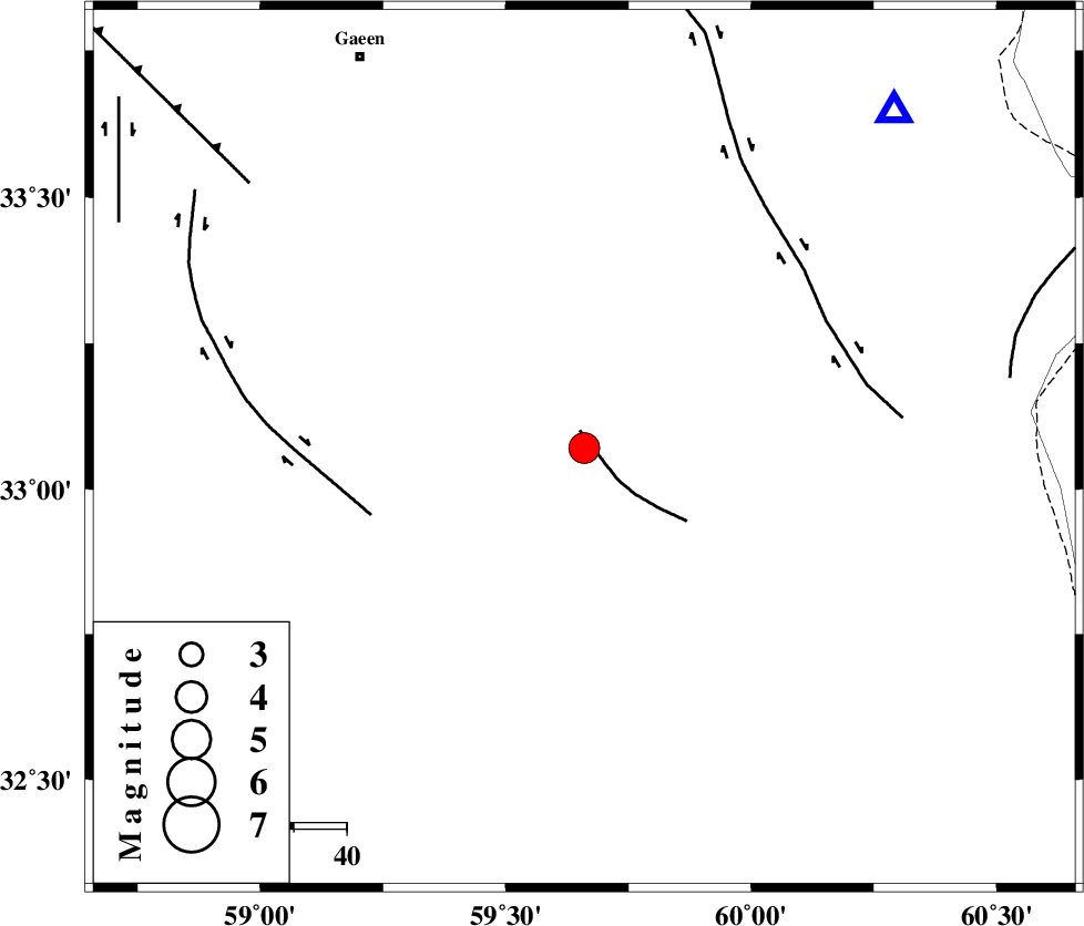
| Location | Lat:33.07 Lon: 59.66 |
| Region | Khorasan(south) Province, 51 km North-West of Sarbisheh |
Nearest Cities |
|
| 5 km North of Gasak, Khorasan(south) Province | |
| 12 km of Derakhsh, Khorasan(south) Province | |
| 15 km North of Asadieh, Khorasan(south) Province | |
| 27 km North East of Marg, Khorasan(south) Province | |
| 34 km North East of Hajiabad, Khorasan(south) Province | |
| Depth | 14 km |
| Agency | |
Faults within 150 km: |
|
| NOZAD_F (Length: 27 km) , Distance to epicenter: 3 km | |
| MOHAMMADABAD_F (Length: 71 km) , Distance to epicenter: 42 km | |
| ABRIZ_F (Length: 114 km) , Distance to epicenter: 52 km | |
| Number of Phases | 6 |
| RMS | 0.1 |
| Number of Stations | 5 |
| Error in Latitude | >2.7 km |
| Error in Longitude | 6 km |
| Error in Depth | 7.4 km |
Download waveform in seisan format
to download seisan software Click here
to access information about IIEES stations Click here
Amplitude | ||||||||
| UID | Agency | Station | Component | Amplitude | Period | Arrival Time | Proccessing Time | Signal Clip |
| 95933 | IIEES | KRBR | N | 191.5 | 0.6 | 2015-06-13 16:43:37 | 2015-06-13 06:02:00 | n |
Phase | ||||||||||||
| Agency | Station | Component | Phase Type | Phase Quality | First Motion | Observed Arrival Time | Time Residual | Loc. Flag | Input Weight | Distance | Azimuth | |
| IIEES | SHRT | Z | Pg | E | 2015-06-13 16:41:35 | 0.04 | y | 86.9 | 42 | |||
| IIEES | BSRN | Z | Pg | E | 2015-06-13 16:41:42 | -0.14 | y | 132 | 203 | |||
| IIEES | BSRN | E | Sg | E | 2015-06-13 16:41:58 | 0.06 | y | 132 | 203 | |||
| IIEES | TABS | Z | Pn | E | 2015-06-13 16:41:58 | 0.13 | y | 245 | 286 | |||
| IIEES | KRBR | Z | Pn | E | 2015-06-13 16:42:22 | 0.05 | y | 439 | 220 | |||
| IIEES | SHRO | Z | Pn | E | 2015-06-13 16:42:25 | -0.18 | y | 468 | 315 | |||