
Magnitude |
:2.7 |
| Date & Time (UTC) | 2015-06-09 15:31:09.1 |
| Date & Time (Local) | 1394/3/19 20:01:09.1 |
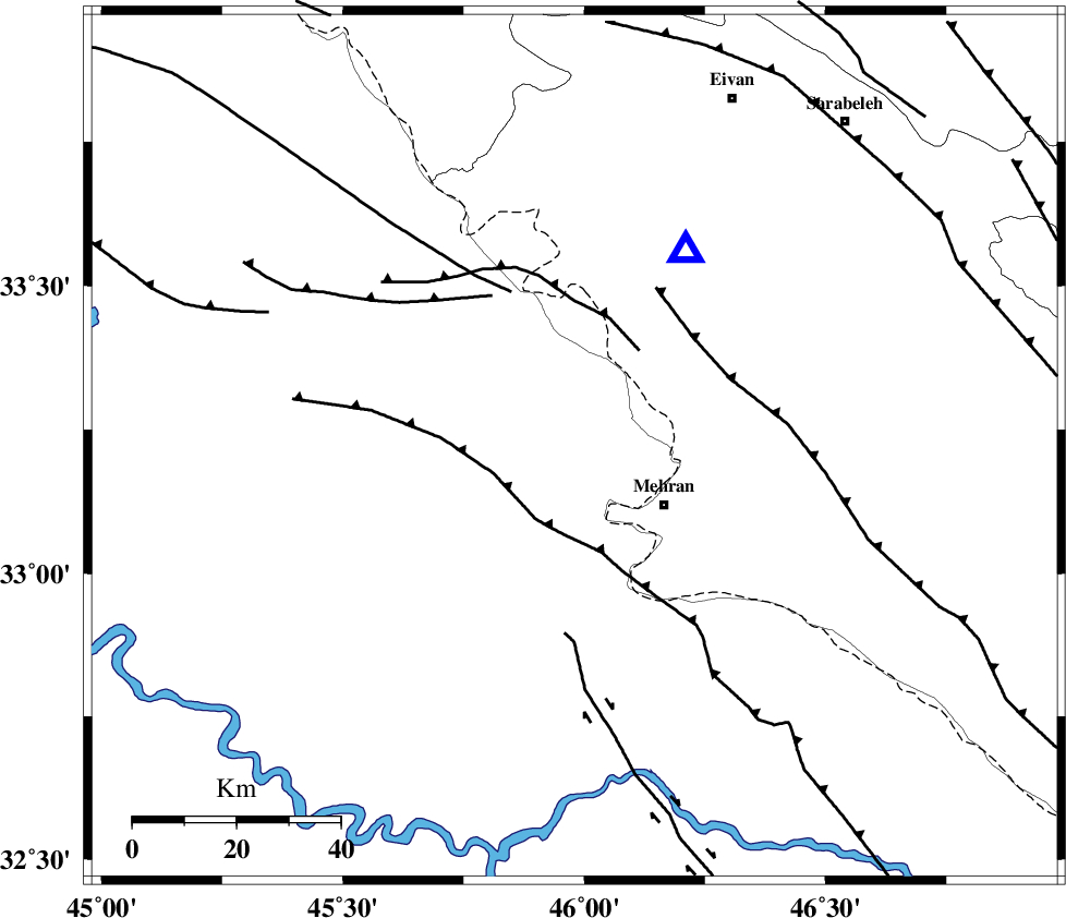
| Location | Lat:33.22 Lon: 45.98 |
| Region | Iraq, 21 km North-West of Mehran |
Nearest Cities |
|
| 21 km North West of Mehran, Ilam Province | |
| 34 km South West of Salehabad, Ilam Province | |
| 44 km South West of Galeh-yedarre-hemalakshahi, Ilam Province | |
| 52 km South West of Mehr, Ilam Province | |
| 54 km West of Gonbad-e pirmohammad, Ilam Province | |
| Depth | 14 km |
| Agency | |
Faults within 150 km: |
|
| ZFF4 (Length: 128 km) , Distance to epicenter: 11 km | |
| MFF6 (Length: 144 km) , Distance to epicenter: 34 km | |
| MFF7 (Length: 99 km) , Distance to epicenter: 42 km | |
| Number of Phases | 6 |
| RMS | 0.3 |
| Number of Stations | 4 |
| Error in Latitude | >8.5 km |
| Error in Longitude | 30.4 km |
| Error in Depth | 27.5 km |
Download waveform in seisan format
to download seisan software Click here
to access information about IIEES stations Click here
Amplitude | ||||||||
| UID | Agency | Station | Component | Amplitude | Period | Arrival Time | Proccessing Time | Signal Clip |
| 95926 | IIEES | SNGE | N | 49.2 | 0.7 | 2015-06-09 15:32:25 | 2015-06-10 10:00:00 | n |
| 95927 | IIEES | SHGR | E | 35.1 | 0.56 | 2015-06-09 15:32:58 | 2015-06-10 10:00:00 | n |
Phase | ||||||||||||
| Agency | Station | Component | Phase Type | Phase Quality | First Motion | Observed Arrival Time | Time Residual | Loc. Flag | Input Weight | Distance | Azimuth | |
| IIEES | SNGE | Z | Pn | E | 2015-06-09 15:31:47 | 0.36 | y | 243 | 31 | |||
| IIEES | SNGE | N | Sg | E | 2015-06-09 15:32:17 | -0.21 | y | 243 | 31 | |||
| IIEES | SHGR | Z | Pn | E | 2015-06-09 15:31:52 | -0.46 | y | 292 | 114 | |||
| IIEES | SHGR | N | Sg | E | 2015-06-09 15:32:31 | 0.19 | y | 292 | 114 | |||
| IIEES | KHMZ | Z | Pn | E | 2015-06-09 15:32:03 | -0.15 | y | 375 | 80 | |||
| IIEES | ASAO | Z | Pn | E | 2015-06-09 15:32:07 | 0.29 | y | 402 | 67 | |||