
Magnitude |
:3.2 |
| Date & Time (UTC) | 2015-06-09 09:54:17.1 |
| Date & Time (Local) | 1394/3/19 14:24:17.1 |
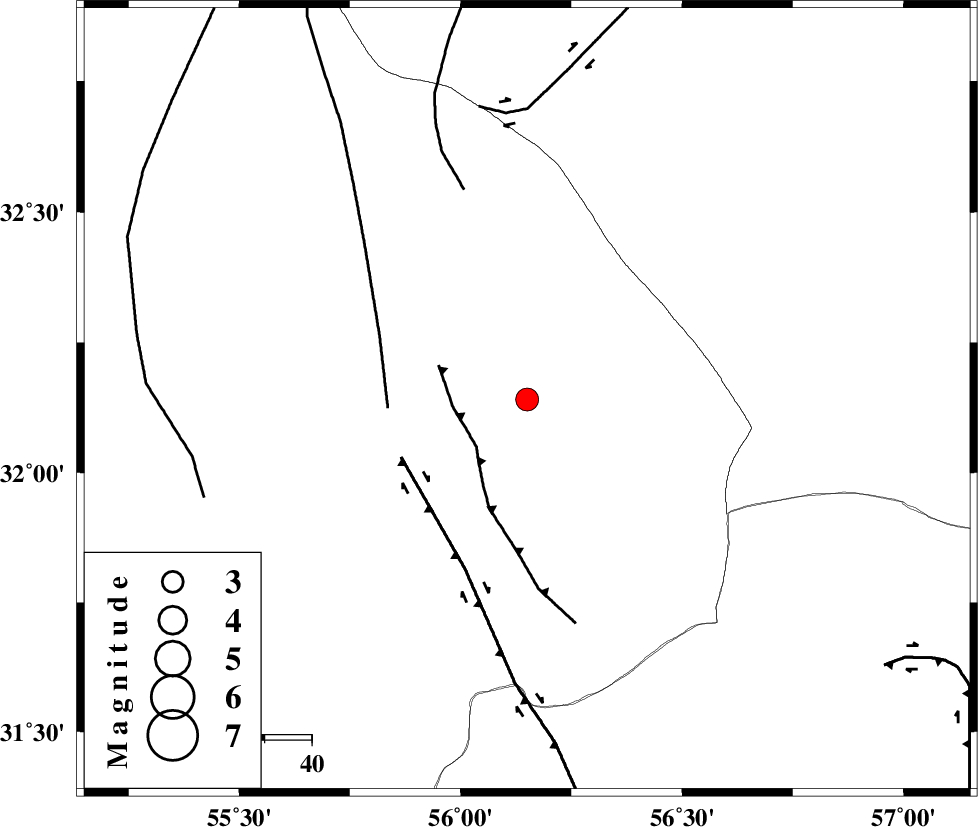
| Location | Lat:32.14 Lon: 56.15 |
| Region | Yazd Province, 93 km North-East of Bafq |
Nearest Cities |
|
| 32 km North East of Behabad, Yazd Province | |
| 46 km North of Benestan, Yazd Province | |
| 53 km North of Asfih, Yazd Province | |
| 56 km North East of Kushk, Yazd Province | |
| 75 km North East of Basab, Yazd Province | |
| Depth | 14 km |
| Agency | |
Faults within 150 km: |
|
| JAFARABAD_F (Length: 60 km) , Distance to epicenter: 14 km | |
| KUHBANAN_F (Length: 189 km) , Distance to epicenter: 30 km | |
| SARBALA_F (Length: 92 km) , Distance to epicenter: 30 km | |
| Number of Phases | 7 |
| RMS | 0.2 |
| Number of Stations | 6 |
| Error in Latitude | >1.9 km |
| Error in Longitude | 3.6 km |
| Error in Depth | 5.5 km |
Download waveform in seisan format
to download seisan software Click here
to access information about IIEES stations Click here
Amplitude | ||||||||
| UID | Agency | Station | Component | Amplitude | Period | Arrival Time | Proccessing Time | Signal Clip |
| 95922 | IIEES | KRBR | N | 134 | 0.47 | 2015-06-09 09:55:32 | 2015-06-09 12:33:00 | n |
| 95923 | IIEES | KRBR | E | 194.7 | 0.37 | 2015-06-09 09:55:33 | 2015-06-09 12:33:00 | n |
Phase | ||||||||||||
| Agency | Station | Component | Phase Type | Phase Quality | First Motion | Observed Arrival Time | Time Residual | Loc. Flag | Input Weight | Distance | Azimuth | |
| IIEES | YZKH | Z | Pg | E | 2015-06-09 09:54:42 | 0.02 | y | 150 | 281 | |||
| IIEES | TABS | Z | Pg | E | 2015-06-09 09:54:48 | -0.06 | y | 190 | 28 | |||
| IIEES | KRBR | Z | Pn | E | 2015-06-09 09:54:55 | 0.28 | y | 246 | 166 | |||
| IIEES | KRBR | N | Sg | E | 2015-06-09 09:55:26 | -0.14 | y | 246 | 166 | |||
| IIEES | BSRN | Z | P | E | 2015-06-09 09:54:59 | -0.28 | y | 281 | 93 | |||
| IIEES | SHRT | Z | Pn | E | 2015-06-09 09:55:17 | 0.42 | y | 422 | 66 | |||
| IIEES | SHRO | Z | Pn | E | 2015-06-09 09:55:18 | -0.19 | y | 430 | 358 | |||