
Magnitude |
:3 |
| Date & Time (UTC) | 2015-06-07 04:40:45.1 |
| Date & Time (Local) | 1394/3/17 09:10:45.1 |
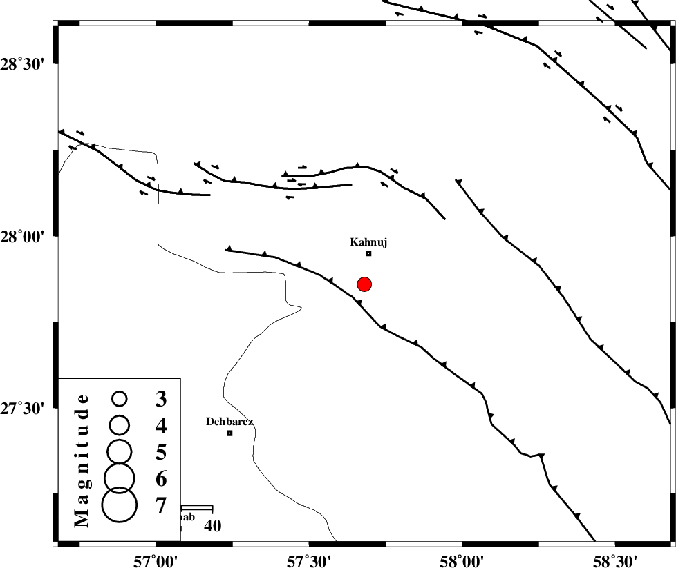
| Location | Lat:27.86 Lon: 57.68 |
| Region | Kerman Province, 11 km Kahnuj |
Nearest Cities |
|
| 10 km of Kahnuj, Kerman Province | |
| 25 km North of Bargah, Kerman Province | |
| 36 km North East of Bejogan, Kerman Province | |
| 37 km South East of Mehrueye-e paeen, Kerman Province | |
| 40 km North East of Fariab, Hormozgan Province | |
| Depth | 14 km |
| Agency | |
Faults within 150 km: |
|
| SABZEVARAN_F (Length: 190 km) , Distance to epicenter: 6 km | |
| JIROFT_F (Length: 144 km) , Distance to epicenter: 14 km | |
| ZENDAN_MINAB_F_Z1 (Length: 183 km) , Distance to epicenter: 73 km | |
| Number of Phases | 6 |
| RMS | 0.2 |
| Number of Stations | 4 |
| Error in Latitude | >2.2 km |
| Error in Longitude | 3.6 km |
| Error in Depth | 7.3 km |
Download waveform in seisan format
to download seisan software Click here
to access information about IIEES stations Click here
Amplitude | ||||||||
| UID | Agency | Station | Component | Amplitude | Period | Arrival Time | Proccessing Time | Signal Clip |
| 95896 | IIEES | BNDS | E | 206.9 | 0.4 | 2015-06-07 04:41:41 | 2015-06-07 06:22:00 | n |
| 95897 | IIEES | KRBR | N | 112.9 | 0.31 | 2015-06-07 04:41:59 | 2015-06-07 06:22:00 | n |
| 95898 | IIEES | KRBR | E | 85 | 0.27 | 2015-06-07 04:42:00 | 2015-06-07 06:22:00 | n |
Phase | ||||||||||||
| Agency | Station | Component | Phase Type | Phase Quality | First Motion | Observed Arrival Time | Time Residual | Loc. Flag | Input Weight | Distance | Azimuth | |
| IIEES | BNDS | Z | Pg | E | 2015-06-07 04:41:11 | 0.09 | y | 157 | 252 | |||
| IIEES | BNDS | E | Sg | E | 2015-06-07 04:41:30 | -0.07 | y | 157 | 252 | |||
| IIEES | KRBR | Z | Pn | E | 2015-06-07 04:41:24 | 0.25 | y | 252 | 339 | |||
| IIEES | ZHSF | Z | Pn | E | 2015-06-07 04:41:37 | -0.14 | y | 360 | 57 | |||
| IIEES | YZKH | Z | Pn | E | 2015-06-07 04:42:05 | -0.17 | y | 584 | 330 | |||
| IIEES | YZKH | E | Sg | E | 2015-06-07 04:43:27 | -0.1 | y | 584 | 330 | |||