
Magnitude |
:2.5 |
| Date & Time (UTC) | 2015-06-07 02:30:21.7 |
| Date & Time (Local) | 1394/3/17 07:00:21.7 |
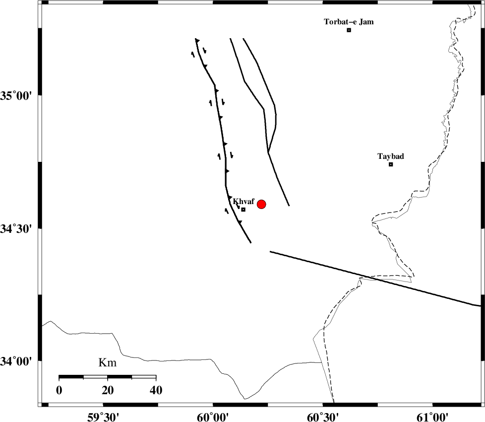
| Location | Lat:34.59 Lon: 60.22 |
| Region | Khorasan(center) Province, 8 km Khaf |
Nearest Cities |
|
| 8 km North of Kharkord, Khorasan(center) Province | |
| 8 km North of Khaf, Khorasan(center) Province | |
| 22 km North of Sangan, Khorasan(center) Province | |
| 29 km South East of Salami, Khorasan(center) Province | |
| 32 km North West of Karat, Khorasan(center) Province | |
| Depth | 14 km |
| Agency | |
Faults within 150 km: |
|
| DORUNEH_F (Length: 713 km) , Distance to epicenter: 29 km | |
| KHAF_F (Length: 58 km) , Distance to epicenter: 31 km | |
| JANGAL_F (Length: 111 km) , Distance to epicenter: 31 km | |
| Number of Phases | 5 |
| RMS | 0.1 |
| Number of Stations | 3 |
| Error in Latitude | >4.9 km |
| Error in Longitude | 3.7 km |
| Error in Depth | 6.1 km |
Download waveform in seisan format
to download seisan software Click here
to access information about IIEES stations Click here
Amplitude | ||||||||
| UID | Agency | Station | Component | Amplitude | Period | Arrival Time | Proccessing Time | Signal Clip |
| 95895 | IIEES | TABS | N | 16.3 | 0.32 | 2015-06-07 02:32:01 | 2015-06-07 03:56:00 | n |
Phase | ||||||||||||
| Agency | Station | Component | Phase Type | Phase Quality | First Motion | Observed Arrival Time | Time Residual | Loc. Flag | Input Weight | Distance | Azimuth | |
| IIEES | SHRT | Z | Pg | E | 2015-06-07 02:30:39 | -0.15 | y | 104 | 177 | |||
| IIEES | SHRT | N | Sg | E | 2015-06-07 02:30:52 | 0.02 | y | 104 | 177 | |||
| IIEES | TABS | Z | Pn | E | 2015-06-07 02:31:07 | -0.04 | y | 305 | 251 | |||
| IIEES | TABS | N | Sg | E | 2015-06-07 02:31:47 | -0.02 | y | 305 | 251 | |||
| IIEES | BSRN | Z | Pn | E | 2015-06-07 02:31:08 | 0.2 | y | 308 | 200 | |||