
Magnitude |
:2.4 |
| Date & Time (UTC) | 2015-06-04 02:09:55.1 |
| Date & Time (Local) | 1394/3/14 06:39:55.1 |
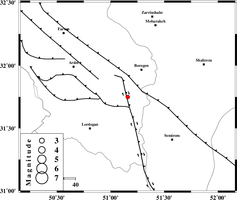
| Location | Lat:31.75 Lon: 51.16 |
| Region | Chaharmahal Bakhtiari Province, 27 km South-West of Borujen |
Nearest Cities |
|
| 13 km South of Gandoman, Chaharmahal Bakhtiari Province | |
| 22 km South East of Baladaji, Chaharmahal Bakhtiari Province | |
| 24 km North East of Aluni, Chaharmahal Bakhtiari Province | |
| 27 km South West of Borujen, Chaharmahal Bakhtiari Province | |
| 28 km South of Faradonbeh, Chaharmahal Bakhtiari Province | |
| Depth | 14 km |
| Agency | |
Faults within 150 km: |
|
| DENA_F (Length: 137 km) , Distance to epicenter: 7 km | |
| DOPOLAN_F (Length: 107 km) , Distance to epicenter: 9 km | |
| MAIN_ZAGROS_R_F (Length: 1106 km) , Distance to epicenter: 14 km | |
| Number of Phases | 7 |
| RMS | 0.1 |
| Number of Stations | 4 |
| Error in Latitude | >7.4 km |
| Error in Longitude | 3.2 km |
| Error in Depth | 10.9 km |
Download waveform in seisan format
to download seisan software Click here
to access information about IIEES stations Click here
Amplitude | ||||||||
| UID | Agency | Station | Component | Amplitude | Period | Arrival Time | Proccessing Time | Signal Clip |
| 95868 | IIEES | GHVR | E | 9.5 | 0.6 | 2015-06-04 02:11:32 | 2015-06-04 04:10:00 | n |
| 95869 | IIEES | ASAO | N | 17.8 | 0.68 | 2015-06-04 02:11:37 | 2015-06-04 04:10:00 | n |
| 95870 | IIEES | ASAO | E | 10.2 | 0.64 | 2015-06-04 02:11:39 | 2015-06-04 04:10:00 | n |
Phase | ||||||||||||
| Agency | Station | Component | Phase Type | Phase Quality | First Motion | Observed Arrival Time | Time Residual | Loc. Flag | Input Weight | Distance | Azimuth | |
| IIEES | NASN | Z | Pn | E | 2015-06-04 02:10:27 | 0.06 | y | 194 | 53 | |||
| IIEES | NASN | N | Sg | E | 2015-06-04 02:10:50 | -0.05 | y | 194 | 53 | |||
| IIEES | KHMZ | Z | Pn | E | 2015-06-04 02:10:33 | -0.01 | y | 247 | 333 | |||
| IIEES | GHVR | Z | Pn | E | 2015-06-04 02:10:40 | 0.04 | y | 303 | 2 | |||
| IIEES | GHVR | E | Sg | E | 2015-06-04 02:11:20 | 0.05 | y | 303 | 2 | |||
| IIEES | ASAO | Z | Pn | E | 2015-06-04 02:10:43 | -0.08 | y | 327 | 341 | |||
| IIEES | ASAO | N | Sg | E | 2015-06-04 02:11:27 | -0.02 | y | 327 | 341 | |||