
Magnitude |
:2.7 |
| Date & Time (UTC) | 2015-06-02 06:13:29.9 |
| Date & Time (Local) | 1394/3/12 10:43:29.9 |
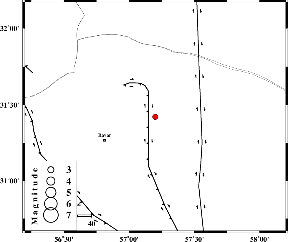
| Location | Lat:31.42 Lon: 57.2 |
| Region | Kerman Province, 41 km North-East of Ravar |
Nearest Cities |
|
| 40 km North East of Dehali, Kerman Province | |
| 41 km North East of Ravar, Kerman Province | |
| 71 km North East of Ahmadi, Kerman Province | |
| 73 km North East of Dasht-e khak, Kerman Province | |
| 75 km North East of Hatkan, Kerman Province | |
| Depth | 14 km |
| Agency | |
Faults within 150 km: |
|
| LAKARKUH_F (Length: 138 km) , Distance to epicenter: 19 km | |
| NAYBAND_F (Length: 258 km) , Distance to epicenter: 39 km | |
| KUHBANAN_F (Length: 189 km) , Distance to epicenter: 81 km | |
| Number of Phases | 7 |
| RMS | 0.2 |
| Number of Stations | 4 |
| Error in Latitude | >1.8 km |
| Error in Longitude | 3.1 km |
| Error in Depth | 7.2 km |
Download waveform in seisan format
to download seisan software Click here
to access information about IIEES stations Click here
Amplitude | ||||||||
| UID | Agency | Station | Component | Amplitude | Period | Arrival Time | Proccessing Time | Signal Clip |
| 95851 | IIEES | KRBR | E | 76.6 | 0.21 | 2015-06-02 06:14:21 | 2015-06-02 07:46:00 | n |
| 95852 | IIEES | KRBR | N | 118.2 | 0.21 | 2015-06-02 06:14:22 | 2015-06-02 07:46:00 | n |
Phase | ||||||||||||
| Agency | Station | Component | Phase Type | Phase Quality | First Motion | Observed Arrival Time | Time Residual | Loc. Flag | Input Weight | Distance | Azimuth | |
| IIEES | KRBR | Z | Pg | E | 2015-06-02 06:13:57 | -0.24 | y | 165 | 195 | |||
| IIEES | KRBR | E | Sg | E | 2015-06-02 06:14:17 | 0.1 | y | 165 | 195 | |||
| IIEES | BSRN | Z | Pg | E | 2015-06-02 06:14:01 | 0.12 | y | 192 | 71 | |||
| IIEES | BSRN | E | Sg | E | 2015-06-02 06:14:24 | -0.14 | y | 192 | 71 | |||
| IIEES | TABS | Z | Pn | E | 2015-06-02 06:14:08 | 0.52 | y | 247 | 358 | |||
| IIEES | TABS | E | Sg | E | 2015-06-02 06:14:39 | -0.23 | y | 247 | 358 | |||
| IIEES | YZKH | Z | Pn | E | 2015-06-02 06:14:11 | -0.14 | y | 269 | 294 | |||