
Magnitude |
:3.7 |
| Date & Time (UTC) | 2015-06-02 01:30:42.7 |
| Date & Time (Local) | 1394/3/12 06:00:42.7 |
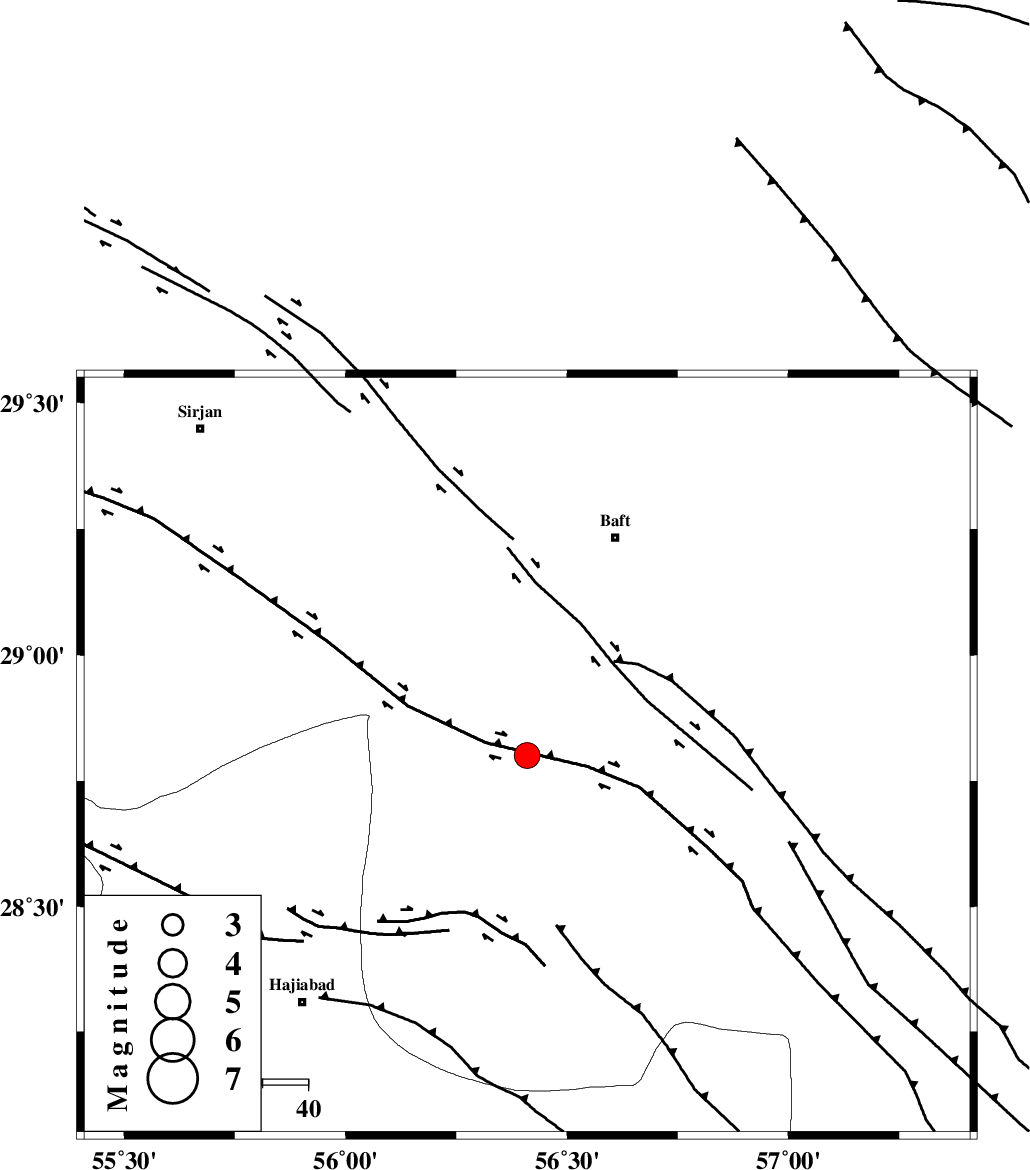
| Location | Lat:28.8 Lon: 56.41 |
| Region | Kerman Province, 52 km South-West of Baft |
Nearest Cities |
|
| 27 km South West of Kashkueyeh, Kerman Province | |
| 38 km North of Shahmaran, Kerman Province | |
| 40 km North of Arzuieeh, Kerman Province | |
| 52 km South West of Baft, Kerman Province | |
| 58 km South West of Bezanjan, Kerman Province | |
| Depth | 15 km |
| Agency | |
Faults within 150 km: |
|
| MAIN_ZAGROS_R_F (Length: 1106 km) , Distance to epicenter: 58 km | |
| LALEHZAR_F (Length: 52 km) , Distance to epicenter: 76 km | |
| HZF2 (Length: 437 km) , Distance to epicenter: 91 km | |
| Number of Phases | 5 |
| RMS | 0.4 |
| Number of Stations | 4 |
| Error in Latitude | >3.3 km |
| Error in Longitude | 9.6 km |
| Error in Depth | 9.5 km |
Download waveform in seisan format
to download seisan software Click here
to access information about IIEES stations Click here
Amplitude | ||||||||
| UID | Agency | Station | Component | Amplitude | Period | Arrival Time | Proccessing Time | Signal Clip |
| 95848 | IIEES | KRBR | E | 1962.9 | 0.24 | 2015-06-02 01:31:23 | 2015-06-02 03:11:00 | n |
| 95849 | IIEES | KRBR | N | 1406.7 | 0.28 | 2015-06-02 01:31:24 | 2015-06-02 03:11:00 | n |
| 95850 | IIEES | BNDS | N | 804.8 | 0.4 | 2015-06-02 01:31:36 | 2015-06-02 03:11:00 | n |
Phase | ||||||||||||
| Agency | Station | Component | Phase Type | Phase Quality | First Motion | Observed Arrival Time | Time Residual | Loc. Flag | Input Weight | Distance | Azimuth | |
| IIEES | KRBR | Z | Pg | E | 2015-06-02 01:31:04 | -0.45 | y | 135 | 15 | |||
| IIEES | KRBR | N | Sg | E | 2015-06-02 01:31:21 | -0.1 | y | 135 | 15 | |||
| IIEES | BNDS | Z | Pg | E | 2015-06-02 01:31:08 | -0.23 | y | 157 | 189 | |||
| IIEES | YZKH | Z | Pn | E | 2015-06-02 01:31:45 | 0.59 | y | 434 | 337 | |||
| IIEES | ZHSF | Z | P | E | 2015-06-02 01:31:44 | 0.46 | y | 434 | 77 | |||