
Magnitude |
:2.3 |
| Date & Time (UTC) | 2015-05-26 14:19:49.6 |
| Date & Time (Local) | 1394/3/5 18:49:49.6 |
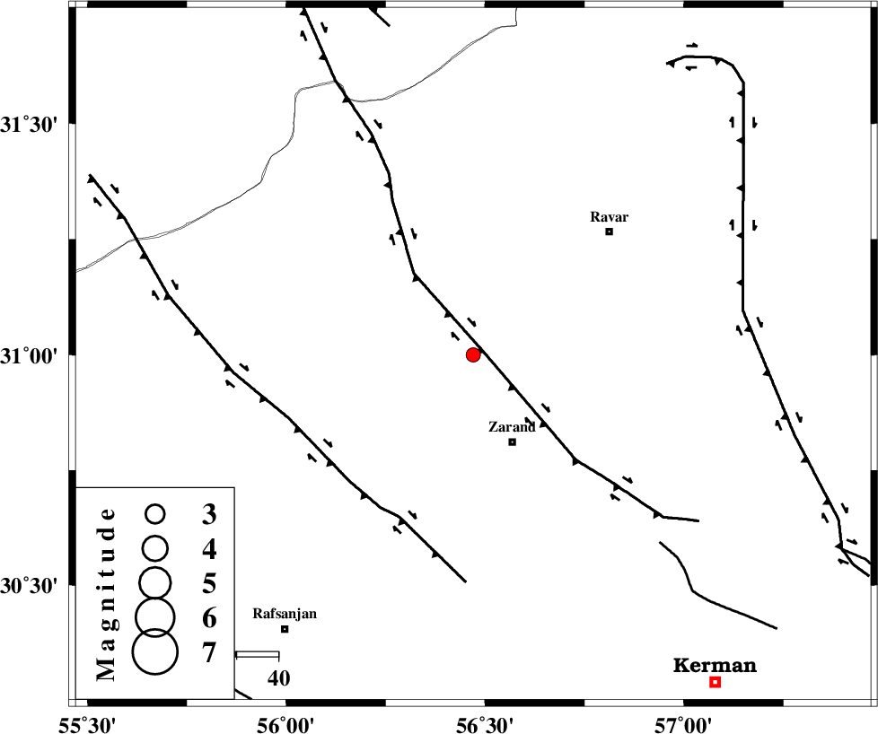
| Location | Lat:31 Lon: 56.47 |
| Region | Kerman Province, 23 km North of Zarand |
Nearest Cities |
|
| 11 km of Dasht-e khak, Kerman Province | |
| 15 km West of Ahmadi, Kerman Province | |
| 17 km South of Toghroljerd, Kerman Province | |
| 23 km North of Zarand, Kerman Province | |
| 25 km North of Mohammadabad, Kerman Province | |
| Depth | 14 km |
| Agency | |
Faults within 150 km: |
|
| KUHBANAN_F (Length: 189 km) , Distance to epicenter: 3 km | |
| DARIVAN_F (Length: 131 km) , Distance to epicenter: 43 km | |
| CHATRUD_F (Length: 37 km) , Distance to epicenter: 64 km | |
| Number of Phases | 4 |
| RMS | 0 |
| Number of Stations | 3 |
| Error in Latitude | >2.4 km |
| Error in Longitude | 2.5 km |
| Error in Depth | 5.7 km |
Download waveform in seisan format
to download seisan software Click here
to access information about IIEES stations Click here
Amplitude | ||||||||
| UID | Agency | Station | Component | Amplitude | Period | Arrival Time | Proccessing Time | Signal Clip |
| 95800 | IIEES | KRBR | E | 70.3 | 0.36 | 2015-05-26 14:20:29 | 2015-05-26 04:34:00 | n |
| 95801 | IIEES | KRBR | N | 71.8 | 0.24 | 2015-05-26 14:20:29 | 2015-05-26 04:34:00 | n |
Phase | ||||||||||||
| Agency | Station | Component | Phase Type | Phase Quality | First Motion | Observed Arrival Time | Time Residual | Loc. Flag | Input Weight | Distance | Azimuth | |
| IIEES | KRBR | Z | Pg | E | 2015-05-26 14:20:09 | 0 | y | 117 | 166 | |||
| IIEES | YZKH | Z | Pn | E | 2015-05-26 14:20:26 | -0.03 | y | 235 | 311 | |||
| IIEES | BSRN | Z | Pn | E | 2015-05-26 14:20:31 | 0.05 | y | 274 | 66 | |||
| IIEES | BSRN | N | Sg | E | 2015-05-26 14:21:06 | -0.02 | y | 274 | 66 | |||