
Magnitude |
:3.1 |
| Date & Time (UTC) | 2015-05-25 16:30:54.4 |
| Date & Time (Local) | 1394/3/4 21:00:54.4 |
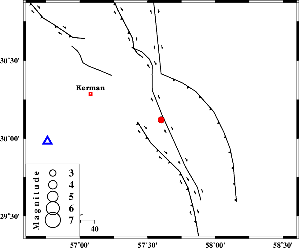
| Location | Lat:30.12 Lon: 57.6 |
| Region | Kerman Province, 53 km South-East of Kerman |
Nearest Cities |
|
| 2 km North of Jushan, Kerman Province | |
| 9 km of Sirch, Kerman Province | |
| 31 km North East of Mahan, Kerman Province | |
| 31 km North East of Langar, Kerman Province | |
| 32 km North West of Golbaft, Kerman Province | |
| Depth | 14 km |
| Agency | |
Faults within 150 km: |
|
| GOLBAF_SIRCH_F (Length: 114 km) , Distance to epicenter: 4 km | |
| GOWK_F (Length: 152 km) , Distance to epicenter: 17 km | |
| SHAHDAD_F (Length: 108 km) , Distance to epicenter: 30 km | |
| Number of Phases | 5 |
| RMS | 0.2 |
| Number of Stations | 4 |
| Error in Latitude | >9 km |
| Error in Longitude | 7.6 km |
| Error in Depth | 6.4 km |
Download waveform in seisan format
to download seisan software Click here
to access information about IIEES stations Click here
Amplitude | ||||||||
| UID | Agency | Station | Component | Amplitude | Period | Arrival Time | Proccessing Time | Signal Clip |
| 95791 | IIEES | BSRN | E | 122.5 | 0.32 | 2015-05-25 16:32:06 | 2015-05-25 05:54:00 | n |
| 95792 | IIEES | BSRN | N | 96.5 | 0.24 | 2015-05-25 16:32:06 | 2015-05-25 05:54:00 | n |
Phase | ||||||||||||
| Agency | Station | Component | Phase Type | Phase Quality | First Motion | Observed Arrival Time | Time Residual | Loc. Flag | Input Weight | Distance | Azimuth | |
| IIEES | KRBR | Z | Pg | E | 2015-05-25 16:31:08 | -0.27 | y | 82.4 | 259 | |||
| IIEES | BSRN | Z | Pn | E | 2015-05-25 16:31:33 | 0.29 | y | 251 | 35 | |||
| IIEES | BSRN | E | Sg | E | 2015-05-25 16:32:05 | -0.29 | y | 251 | 35 | |||
| IIEES | YZKH | Z | Pn | E | 2015-05-25 16:31:49 | 0.22 | y | 381 | 312 | |||
| IIEES | TABS | Z | Pn | E | 2015-05-25 16:31:51 | 0.12 | y | 394 | 353 | |||