
Magnitude |
:4.5 |
| Date & Time (UTC) | 2015-05-19 20:26:47.7 |
| Date & Time (Local) | 1394/2/30 00:56:47.7 |
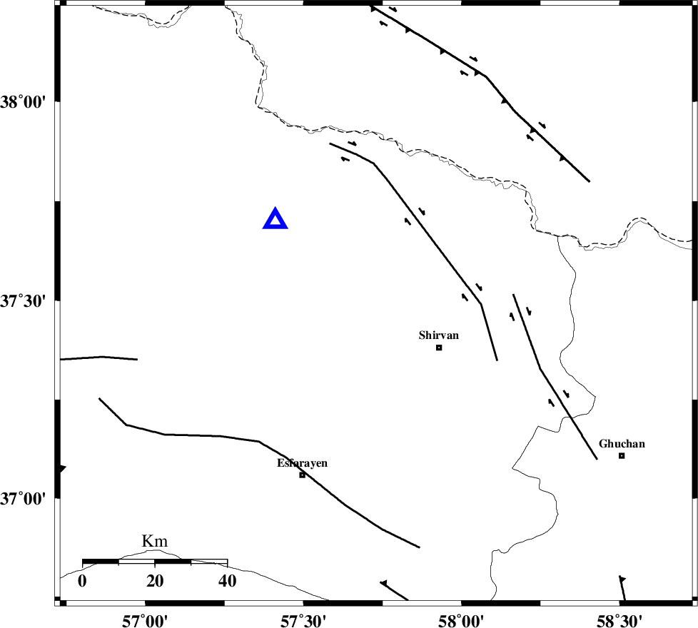
| Location | Lat:37.49 Lon: 57.73 |
| Region | Khorasan(north) Province, 21 km North-West of Shirvan |
Nearest Cities |
|
| 16 km North West of Ziyarat, Khorasan(north) Province | |
| 16 km South of Tukur, Khorasan(north) Province | |
| 18 km South West of Lojali, Khorasan(north) Province | |
| 20 km North of Zavarom, Khorasan(north) Province | |
| 21 km North West of Shirvan, Khorasan(north) Province | |
| Depth | 14 km |
| Agency | |
Faults within 150 km: |
|
| BAGHAN_GERMAB_F (Length: 79 km) , Distance to epicenter: 26 km | |
| GHUCHAN_F (Length: 50 km) , Distance to epicenter: 41 km | |
| ESFARAYEN_F (Length: 111 km) , Distance to epicenter: 49 km | |
| Number of Phases | 6 |
| RMS | 0.1 |
| Number of Stations | 5 |
| Error in Latitude | >4.5 km |
| Error in Longitude | 6 km |
| Error in Depth | 8.7 km |
Download waveform in seisan format
to download seisan software Click here
to access information about IIEES stations Click here
Amplitude | ||||||||
| UID | Agency | Station | Component | Amplitude | Period | Arrival Time | Proccessing Time | Signal Clip |
| 95744 | IIEES | BJRD | E | 47774.2 | 0.28 | 2015-05-19 20:27:01 | 2015-05-19 09:50:00 | n |
| 95745 | IIEES | MRVT | E | 9393.3 | 0.24 | 2015-05-19 20:27:35 | 2015-05-19 09:50:00 | n |
Phase | ||||||||||||
| Agency | Station | Component | Phase Type | Phase Quality | First Motion | Observed Arrival Time | Time Residual | Loc. Flag | Input Weight | Distance | Azimuth | |
| IIEES | BJRD | Z | Pg | E | 2015-05-19 20:26:54 | 0.05 | y | 36.6 | 309 | |||
| IIEES | BJRD | E | Sg | E | 2015-05-19 20:26:59 | 0.04 | y | 36.6 | 309 | |||
| IIEES | MRVT | Z | Pg | E | 2015-05-19 20:27:11 | -0.15 | y | 146 | 278 | |||
| IIEES | SHRO | Z | Pn | E | 2015-05-19 20:27:23 | 0.06 | y | 225 | 223 | |||
| IIEES | TABS | Z | Pn | E | 2015-05-19 20:27:49 | 0.12 | y | 430 | 188 | |||
| IIEES | BSRN | Z | Pn | E | 2015-05-19 20:28:13 | -0.18 | y | 626 | 168 | |||