
Magnitude |
:3.4 |
| Date & Time (UTC) | 2015-05-19 11:27:41.6 |
| Date & Time (Local) | 1394/2/29 15:57:41.6 |
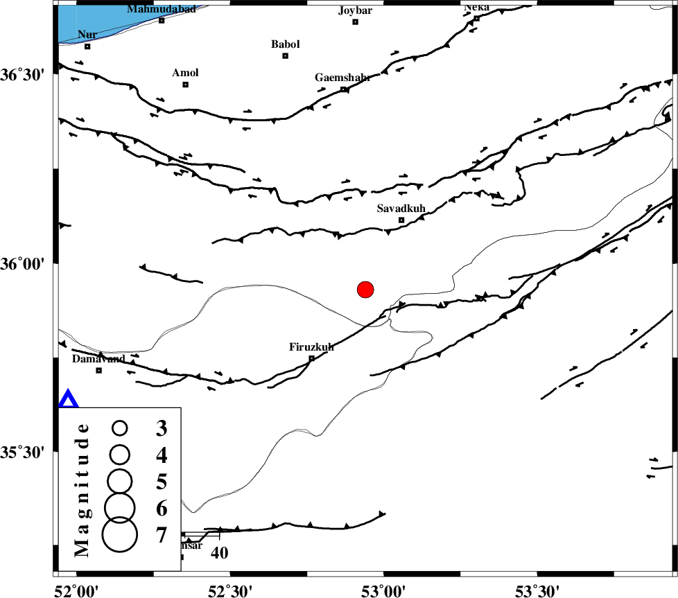
| Location | Lat:35.93 Lon: 52.94 |
| Region | Mazandaran Province, 23 km South-West of Pol-E-Sefid |
Nearest Cities |
|
| 18 km South East of Alasht, Mazandaran Province | |
| 18 km South of Elahband, Mazandaran Province | |
| 21 km South West of Shurmast-e peyrudbar, Mazandaran Province | |
| 23 km South West of Pol-E-Sefid, Mazandaran Province | |
| 26 km North East of Firuzkuh, Tehran Province | |
| Depth | 14 km |
| Agency | |
Faults within 150 km: |
|
| ATARI_F (Length: 185 km) , Distance to epicenter: 26 km | |
| N_ALBORZ_F (Length: 360 km) , Distance to epicenter: 29 km | |
| MOSHA_F (Length: 234 km) , Distance to epicenter: 38 km | |
| Number of Phases | 6 |
| RMS | 0.2 |
| Number of Stations | 5 |
| Error in Latitude | >9 km |
| Error in Longitude | 6.7 km |
| Error in Depth | 9.6 km |
Download waveform in seisan format
to download seisan software Click here
to access information about IIEES stations Click here
Amplitude | ||||||||
| UID | Agency | Station | Component | Amplitude | Period | Arrival Time | Proccessing Time | Signal Clip |
| 95743 | IIEES | GHVR | E | 279.1 | 0.48 | 2015-05-19 11:28:55 | 2015-05-19 01:13:00 | n |
Phase | ||||||||||||
| Agency | Station | Component | Phase Type | Phase Quality | First Motion | Observed Arrival Time | Time Residual | Loc. Flag | Input Weight | Distance | Azimuth | |
| IIEES | DAMV | Z | Pg | E | 2015-05-19 11:27:57 | -0.12 | y | 94 | 250 | |||
| IIEES | THKV | Z | Pg | E | 2015-05-19 11:28:12 | 0.16 | y | 186 | 270 | |||
| IIEES | GHVR | Z | Pn | E | 2015-05-19 11:28:17 | 0.47 | y | 223 | 224 | |||
| IIEES | SHRO | Z | Pn | E | 2015-05-19 11:28:23 | -0.13 | y | 277 | 87 | |||
| IIEES | ASAO | Z | Pn | E | 2015-05-19 11:28:27 | -0.22 | y | 307 | 241 | |||
| IIEES | ASAO | N | Sg | E | 2015-05-19 11:29:07 | -0.19 | y | 307 | 241 | |||