
Magnitude |
:2.4 |
| Date & Time (UTC) | 2015-05-19 08:28:40.9 |
| Date & Time (Local) | 1394/2/29 12:58:40.9 |
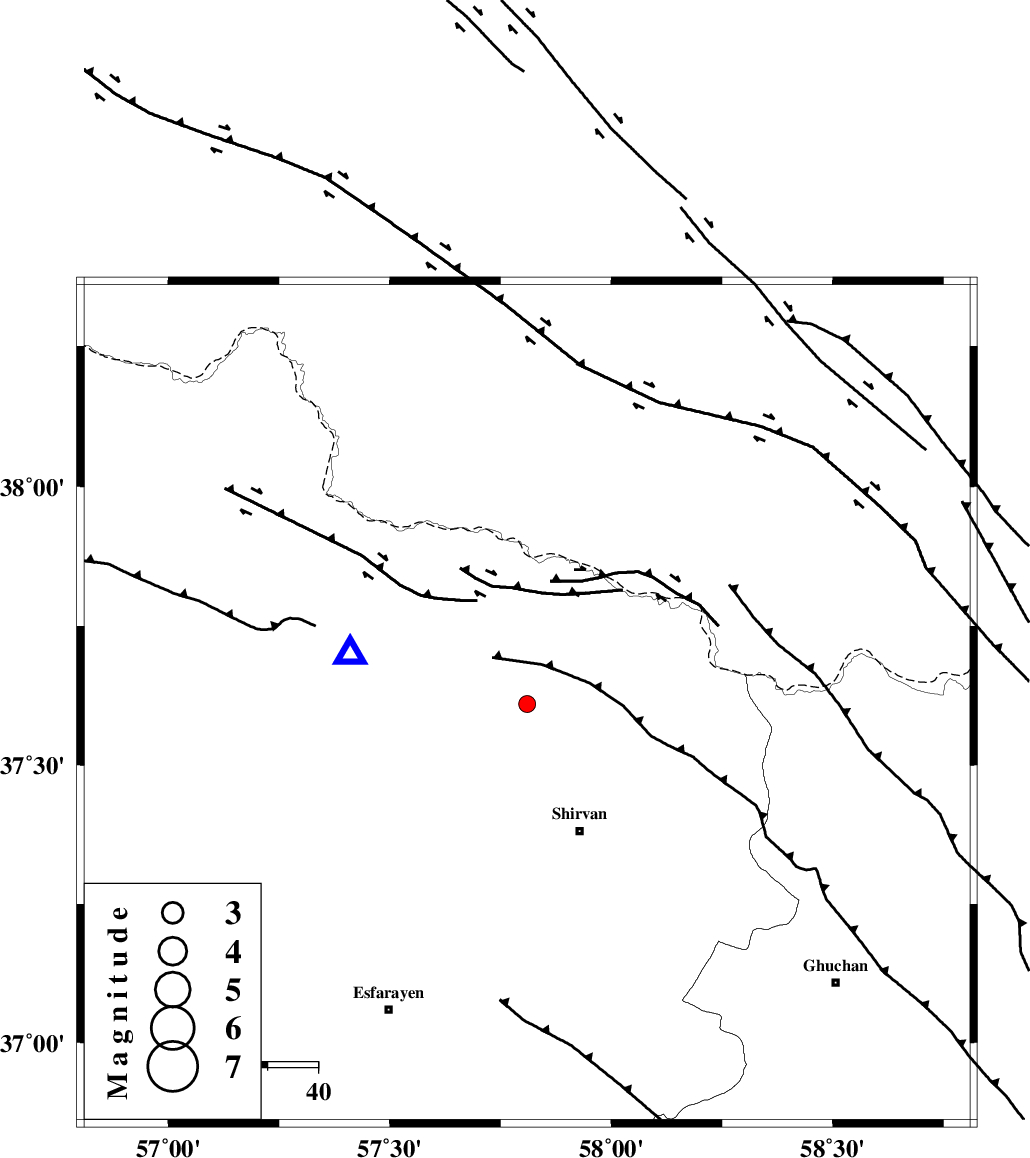
| Location | Lat:37.61 Lon: 57.81 |
| Region | Khorasan(north) Province, 28 km North-West of Shirvan |
Nearest Cities |
|
| 3 km of Tukur, Khorasan(north) Province | |
| 5 km North of Lojali, Khorasan(north) Province | |
| 16 km South of Yangi ghale-ye bala, Khorasan(north) Province | |
| 17 km West of Kuseh, Khorasan(north) Province | |
| 20 km North of Ziyarat, Khorasan(north) Province | |
| Depth | 27 km |
| Agency | |
Faults within 150 km: |
|
| BAGHAN_GERMAB_F (Length: 79 km) , Distance to epicenter: 12 km | |
| GHUCHAN_F (Length: 50 km) , Distance to epicenter: 35 km | |
| MAIN_KOPEHDAGH_F3 (Length: 96 km) , Distance to epicenter: 53 km | |
| Number of Phases | 5 |
| RMS | 0.1 |
| Number of Stations | 3 |
| Error in Latitude | >5.3 km |
| Error in Longitude | 3.7 km |
| Error in Depth | 2.9 km |
Download waveform in seisan format
to download seisan software Click here
to access information about IIEES stations Click here
Amplitude | ||||||||
| UID | Agency | Station | Component | Amplitude | Period | Arrival Time | Proccessing Time | Signal Clip |
| 95741 | IIEES | MRVT | N | 60.5 | 0.48 | 2015-05-19 08:29:29 | 2015-05-19 10:59:00 | n |
| 95742 | IIEES | MRVT | E | 50.9 | 0.28 | 2015-05-19 08:29:29 | 2015-05-19 10:59:00 | n |
Phase | ||||||||||||
| Agency | Station | Component | Phase Type | Phase Quality | First Motion | Observed Arrival Time | Time Residual | Loc. Flag | Input Weight | Distance | Azimuth | |
| IIEES | BJRD | E | Pg | E | 2015-05-19 08:28:48 | 0.09 | y | 36.8 | 285 | |||
| IIEES | BJRD | E | Sg | E | 2015-05-19 08:28:54 | -0.09 | y | 36.8 | 285 | |||
| IIEES | MRVT | Z | Pn | E | 2015-05-19 08:29:06 | -0.03 | y | 152 | 272 | |||
| IIEES | MRVT | N | Sg | E | 2015-05-19 08:29:23 | 0.06 | y | 152 | 272 | |||
| IIEES | SHRO | Z | Pn | E | 2015-05-19 08:29:17 | -0.02 | y | 240 | 223 | |||