
Magnitude |
:2.7 |
| Date & Time (UTC) | 2015-05-19 08:31:22.0 |
| Date & Time (Local) | 1394/2/29 13:01:22.0 |
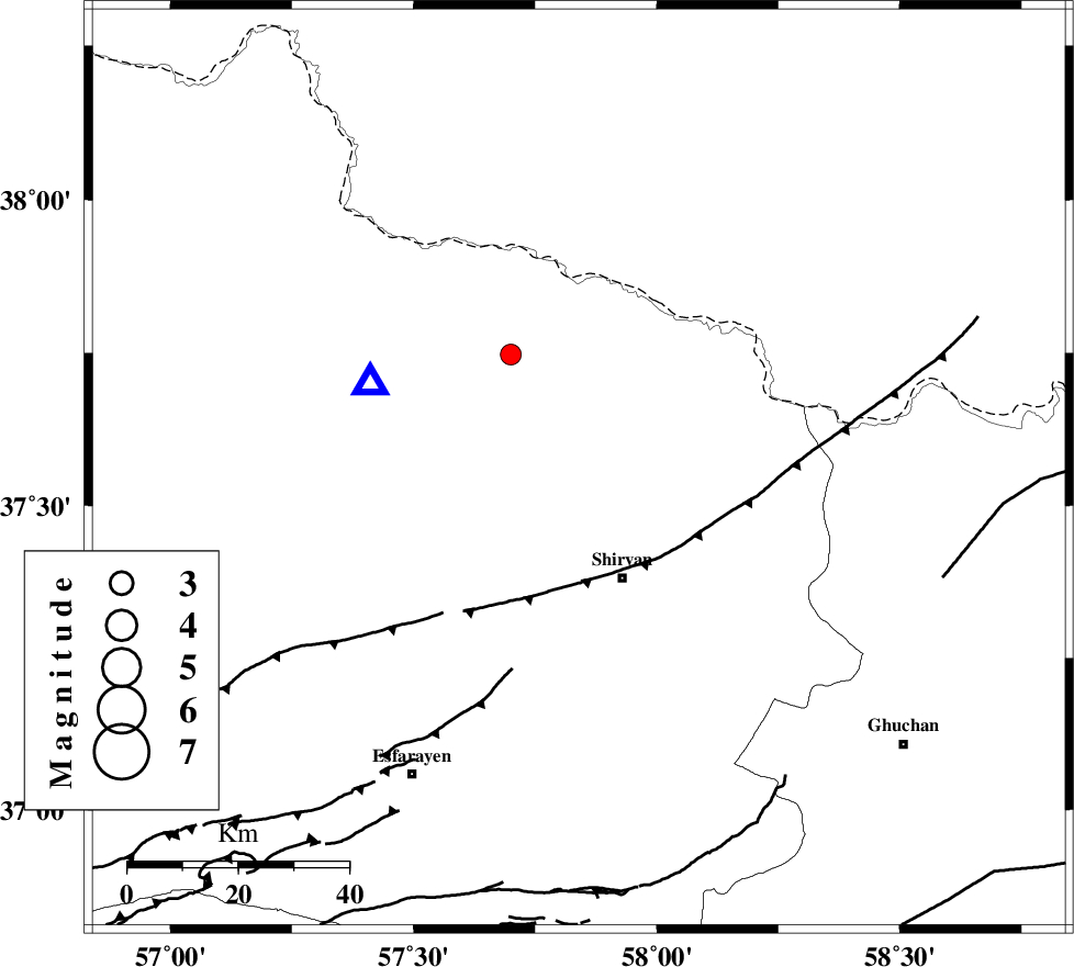
| Location | Lat:37.56 Lon: 57.84 |
| Region | Khorasan(north) Province, 21 km North of Shirvan |
Nearest Cities |
|
| 6 km of Lojali, Khorasan(north) Province | |
| 9 km of Tukur, Khorasan(north) Province | |
| 14 km North of Ziyarat, Khorasan(north) Province | |
| 20 km South West of Kuseh, Khorasan(north) Province | |
| 21 km North West of Haname-ye bozorg, Khorasan(north) Province | |
| Depth | 25 km |
| Agency | |
Faults within 150 km: |
|
| BAGHAN_GERMAB_F (Length: 79 km) , Distance to epicenter: 14 km | |
| GHUCHAN_F (Length: 50 km) , Distance to epicenter: 32 km | |
| MAIN_KOPEHDAGH_F3 (Length: 96 km) , Distance to epicenter: 56 km | |
| Number of Phases | 6 |
| RMS | 0.2 |
| Number of Stations | 3 |
| Error in Latitude | >2.7 km |
| Error in Longitude | 5.7 km |
| Error in Depth | 4.1 km |
Download waveform in seisan format
to download seisan software Click here
to access information about IIEES stations Click here
Amplitude | ||||||||
| UID | Agency | Station | Component | Amplitude | Period | Arrival Time | Proccessing Time | Signal Clip |
| 95739 | IIEES | MRVT | N | 122 | 0.44 | 2015-05-19 08:32:10 | 2015-05-19 09:56:00 | n |
| 95740 | IIEES | MRVT | E | 89.5 | 0.28 | 2015-05-19 08:32:11 | 2015-05-19 09:56:00 | n |
Phase | ||||||||||||
| Agency | Station | Component | Phase Type | Phase Quality | First Motion | Observed Arrival Time | Time Residual | Loc. Flag | Input Weight | Distance | Azimuth | |
| IIEES | BJRD | E | Pg | E | 2015-05-19 08:31:30 | 0.08 | y | 41.2 | 293 | |||
| IIEES | BJRD | E | Sg | E | 2015-05-19 08:31:35 | -0.1 | y | 41.2 | 293 | |||
| IIEES | MRVT | Z | Pn | E | 2015-05-19 08:31:47 | -0.29 | y | 155 | 275 | |||
| IIEES | MRVT | N | Sg | E | 2015-05-19 08:32:05 | 0.19 | y | 155 | 275 | |||
| IIEES | SHRO | Z | Pn | E | 2015-05-19 08:31:58 | 0.25 | y | 237 | 224 | |||
| IIEES | SHRO | Z | Sg | E | 2015-05-19 08:32:27 | -0.13 | y | 237 | 224 | |||