
Magnitude |
:1.8 |
| Date & Time (UTC) | 2015-05-16 07:22:44.0 |
| Date & Time (Local) | 1394/2/26 11:52:44.0 |
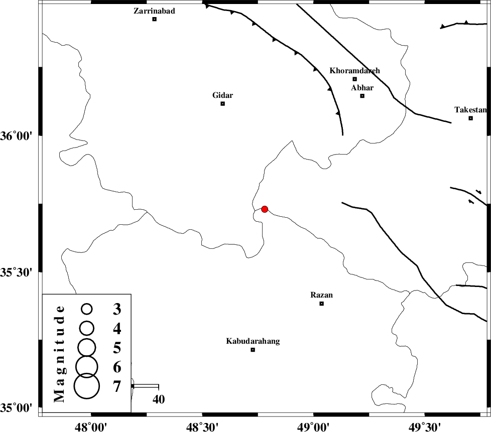
| Location | Lat:35.73 Lon: 48.78 |
| Region | Hamedan Province, 57 km North of Kabudar Ahang |
Nearest Cities |
|
| 11 km North of Kahla, Zanjan Province | |
| 24 km North of Khorandeh, Hamedan Province | |
| 28 km East of Zarrinabad, Zanjan Province | |
| 31 km North of Babanazar, Hamedan Province | |
| 33 km North of Damag, Hamedan Province | |
| Depth | 31 km |
| Agency | |
Faults within 150 km: |
|
| KUSHK_E_NOSRAT_F (Length: 230 km) , Distance to epicenter: 31 km | |
| SOLTANIYEH_F (Length: 119 km) , Distance to epicenter: 44 km | |
| ZANJAN_F (Length: 137 km) , Distance to epicenter: 69 km | |
| Number of Phases | 6 |
| RMS | 0.3 |
| Number of Stations | 3 |
| Error in Latitude | >2.3 km |
| Error in Longitude | 3.2 km |
| Error in Depth | 6 km |
Download waveform in seisan format
to download seisan software Click here
to access information about IIEES stations Click here
Amplitude | ||||||||
| UID | Agency | Station | Component | Amplitude | Period | Arrival Time | Proccessing Time | Signal Clip |
| 95701 | IIEES | ZNJK | N | 16.4 | 0.08 | 2015-05-16 07:23:03 | 2015-05-16 09:44:00 | n |
| 95702 | IIEES | ZNJK | E | 18.3 | 0.24 | 2015-05-16 07:23:15 | 2015-05-16 09:44:00 | n |
| 95703 | IIEES | ASAO | E | 19.9 | 0.32 | 2015-05-16 07:23:34 | 2015-05-16 09:44:00 | n |
| 95704 | IIEES | ASAO | N | 11.1 | 0.32 | 2015-05-16 07:23:36 | 2015-05-16 09:44:00 | n |
Phase | ||||||||||||
| Agency | Station | Component | Phase Type | Phase Quality | First Motion | Observed Arrival Time | Time Residual | Loc. Flag | Input Weight | Distance | Azimuth | |
| IIEES | ZNJK | Z | Pg | E | 2015-05-16 07:23:02 | 0.37 | y | 105 | 355 | |||
| IIEES | ZNJK | E | Sg | E | 2015-05-16 07:23:14 | -0.27 | y | 105 | 355 | |||
| IIEES | SNGE | Z | Pn | E | 2015-05-16 07:23:08 | -0.4 | y | 148 | 242 | |||
| IIEES | SNGE | Z | Sg | E | 2015-05-16 07:23:26 | 0.16 | y | 148 | 242 | |||
| IIEES | ASAO | Z | Pn | E | 2015-05-16 07:23:12 | 0.36 | y | 173 | 139 | |||
| IIEES | ASAO | E | Sg | E | 2015-05-16 07:23:32 | -0.22 | y | 173 | 139 | |||