
Magnitude |
:3.8 |
| Date & Time (UTC) | 2015-05-12 15:28:22.2 |
| Date & Time (Local) | 1394/2/22 19:58:22.2 |
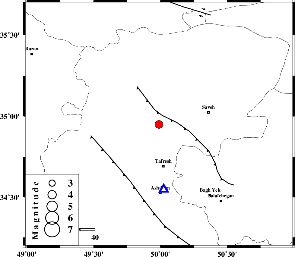
| Location | Lat:34.95 Lon: 49.99 |
| Region | Markazi Province, 29 km North of Tafresh |
Nearest Cities |
|
| 13 km South of Qeytaniyeh, Markazi Province | |
| 13 km North of Khanak, Markazi Province | |
| 19 km North of Bazarjan, Markazi Province | |
| 23 km South East of Gharqabad, Markazi Province | |
| 25 km North East of Jaghtan, Markazi Province | |
| Depth | 14 km |
| Agency | |
Faults within 150 km: |
|
| INDES_F (Length: 98 km) , Distance to epicenter: 7 km | |
| KUSHK_E_NOSRAT_F (Length: 230 km) , Distance to epicenter: 32 km | |
| TAFRESH_F (Length: 117 km) , Distance to epicenter: 40 km | |
| Number of Phases | 6 |
| RMS | 0.1 |
| Number of Stations | 7 |
| Error in Latitude | >1.9 km |
| Error in Longitude | 5 km |
| Error in Depth | 9.6 km |
Download waveform in seisan format
to download seisan software Click here
to access information about IIEES stations Click here
Amplitude | ||||||||
| UID | Agency | Station | Component | Amplitude | Period | Arrival Time | Proccessing Time | Signal Clip |
| 95653 | IIEES | THKV | N | 2456.2 | 0.32 | 2015-05-12 15:29:02 | 2015-05-12 04:51:00 | n |
| 95654 | IIEES | NASN | E | 156 | 0.28 | 2015-05-12 15:29:59 | 2015-05-12 04:51:00 | n |
Phase | ||||||||||||
| Agency | Station | Component | Phase Type | Phase Quality | First Motion | Observed Arrival Time | Time Residual | Loc. Flag | Input Weight | Distance | Azimuth | |
| IIEES | ASAO | Z | Pg | E | 2015-05-12 15:28:30 | 0.09 | y | 44.5 | 176 | |||
| IIEES | GHVR | Z | Pg | E | 2015-05-12 15:28:43 | 0.07 | y | 126 | 114 | |||
| IIEES | KHMZ | Z | Pg | E | 2015-05-12 15:28:44 | -0.17 | y | 134 | 181 | |||
| IIEES | THKV | Z | Pg | E | 2015-05-12 15:28:44 | -0.15 | y | 134 | 37 | |||
| IIEES | CHTH | Z | Pg | E | 2015-05-12 15:28:47 | 0.09 | y | 148 | 44 | |||
| IIEES | SNGE | Z | Pn | E | 2015-05-12 15:29:00 | 0.06 | y | 242 | 275 | |||