
Magnitude |
:2 |
| Date & Time (UTC) | 2015-05-12 11:56:34.1 |
| Date & Time (Local) | 1394/2/22 16:26:34.1 |
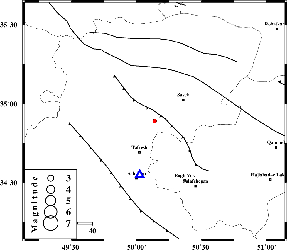
| Location | Lat:34.89 Lon: 50.14 |
| Region | Markazi Province, 24 km North-East of Tafresh |
Nearest Cities |
|
| 7 km North of Khanak, Markazi Province | |
| 16 km West of Yalabad, Markazi Province | |
| 21 km South East of Qeytaniyeh, Markazi Province | |
| 21 km West of Qareh chay, Markazi Province | |
| 23 km North East of Bazarjan, Markazi Province | |
| Depth | 21 km |
| Agency | |
Faults within 150 km: |
|
| INDES_F (Length: 98 km) , Distance to epicenter: 8 km | |
| KUSHK_E_NOSRAT_F (Length: 230 km) , Distance to epicenter: 38 km | |
| TAFRESH_F (Length: 117 km) , Distance to epicenter: 47 km | |
| Number of Phases | 4 |
| RMS | 0 |
| Number of Stations | 3 |
| Error in Latitude | >7 km |
| Error in Longitude | 5.4 km |
| Error in Depth | 7.7 km |
Download waveform in seisan format
to download seisan software Click here
to access information about IIEES stations Click here
Amplitude | ||||||||
| UID | Agency | Station | Component | Amplitude | Period | Arrival Time | Proccessing Time | Signal Clip |
| 95651 | IIEES | ASAO | N | 137.4 | 0.2 | 2015-05-12 11:56:47 | 2015-05-12 02:43:00 | n |
Phase | ||||||||||||
| Agency | Station | Component | Phase Type | Phase Quality | First Motion | Observed Arrival Time | Time Residual | Loc. Flag | Input Weight | Distance | Azimuth | |
| IIEES | ASAO | Z | Pg | E | 2015-05-12 11:56:41 | 0.01 | y | 39.2 | 195 | |||
| IIEES | ASAO | N | Sg | E | 2015-05-12 11:56:47 | -0.01 | y | 39.2 | 195 | |||
| IIEES | GHVR | Z | Pg | E | 2015-05-12 11:56:52 | 0 | y | 111 | 114 | |||
| IIEES | KHMZ | Z | Pg | E | 2015-05-12 11:56:55 | 0 | y | 129 | 187 | |||