
Magnitude |
:2.4 |
| Date & Time (UTC) | 2015-05-10 09:18:11.2 |
| Date & Time (Local) | 1394/2/20 13:48:11.2 |
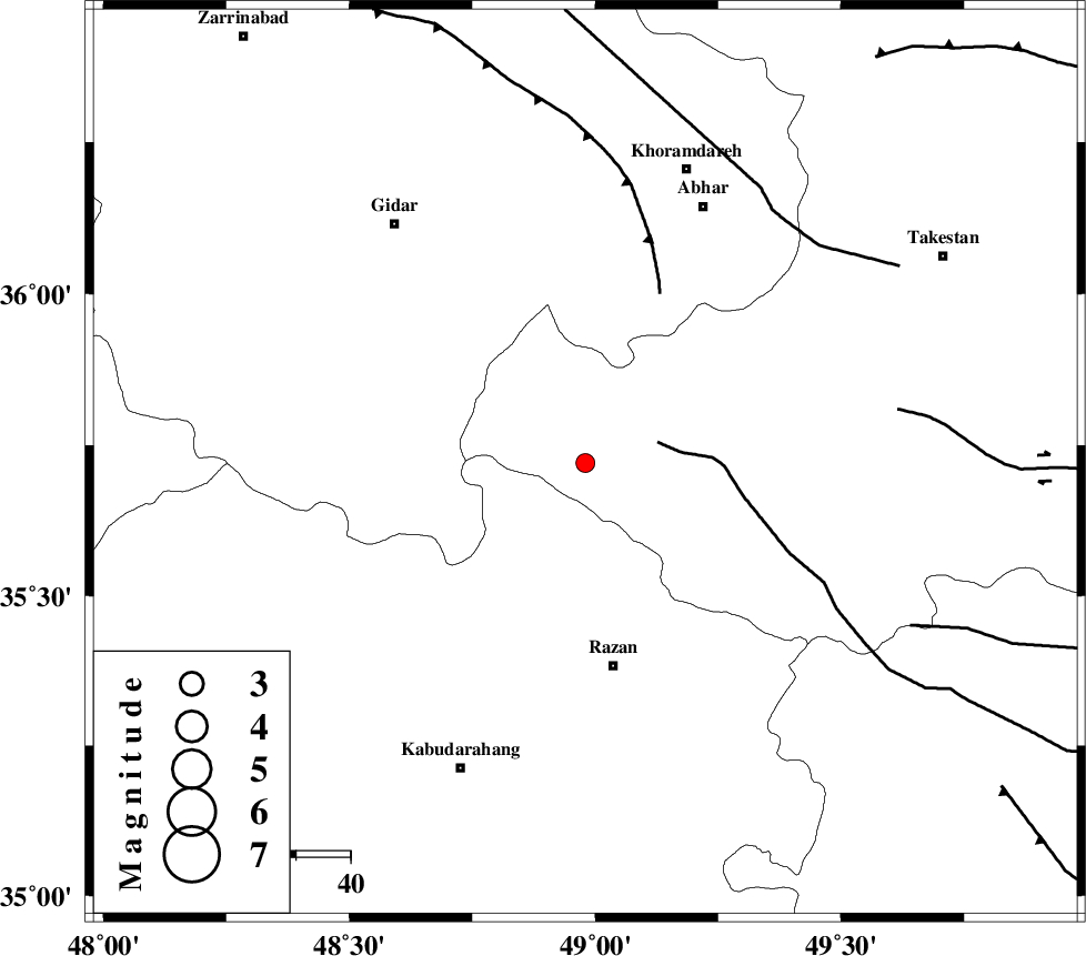
| Location | Lat:35.72 Lon: 48.98 |
| Region | Ghazvin Province, 38 km North of Razan |
Nearest Cities |
|
| 27 km North East of Kahla, Zanjan Province | |
| 28 km North West of Avaj, Ghazvin Province | |
| 28 km North East of Khorandeh, Hamedan Province | |
| 28 km West of Ab-e garm, Ghazvin Province | |
| 34 km North East of Damag, Hamedan Province | |
| Depth | 14 km |
| Agency | |
Faults within 150 km: |
|
| KUSHK_E_NOSRAT_F (Length: 230 km) , Distance to epicenter: 14 km | |
| SOLTANIYEH_F (Length: 119 km) , Distance to epicenter: 34 km | |
| ZANJAN_F (Length: 137 km) , Distance to epicenter: 58 km | |
| Number of Phases | 8 |
| RMS | 0.5 |
| Number of Stations | 5 |
| Error in Latitude | >3.5 km |
| Error in Longitude | 5.7 km |
| Error in Depth | 7.9 km |
Download waveform in seisan format
to download seisan software Click here
to access information about IIEES stations Click here
Amplitude | ||||||||
| UID | Agency | Station | Component | Amplitude | Period | Arrival Time | Proccessing Time | Signal Clip |
| 95636 | IIEES | THKV | N | 42.5 | 0.5 | 2015-05-10 09:19:16 | 2015-05-10 10:58:00 | n |
Phase | ||||||||||||
| Agency | Station | Component | Phase Type | Phase Quality | First Motion | Observed Arrival Time | Time Residual | Loc. Flag | Input Weight | Distance | Azimuth | |
| IIEES | ZNJK | Z | Pg | E | 2015-05-10 09:18:30 | 0.34 | y | 109 | 346 | |||
| IIEES | ZNJK | E | Sg | E | 2015-05-10 09:18:42 | -0.4 | y | 109 | 346 | |||
| IIEES | ASAO | Z | Pn | E | 2015-05-10 09:18:39 | 0.15 | y | 161 | 144 | |||
| IIEES | ASAO | E | Sg | E | 2015-05-10 09:18:56 | -0.69 | y | 161 | 144 | |||
| IIEES | THKV | Z | Pn | E | 2015-05-10 09:18:40 | -0.16 | y | 173 | 82 | |||
| IIEES | THKV | N | Sg | E | 2015-05-10 09:19:01 | 0.44 | y | 173 | 82 | |||
| IIEES | CHTH | Z | Pn | E | 2015-05-10 09:18:42 | -0.38 | y | 195 | 83 | |||
| IIEES | KHMZ | Z | Pn | E | 2015-05-10 09:18:49 | 0.69 | y | 237 | 157 | |||