
Magnitude |
:3.7 |
| Date & Time (UTC) | 2015-05-08 17:09:09.7 |
| Date & Time (Local) | 1394/2/18 21:39:09.7 |
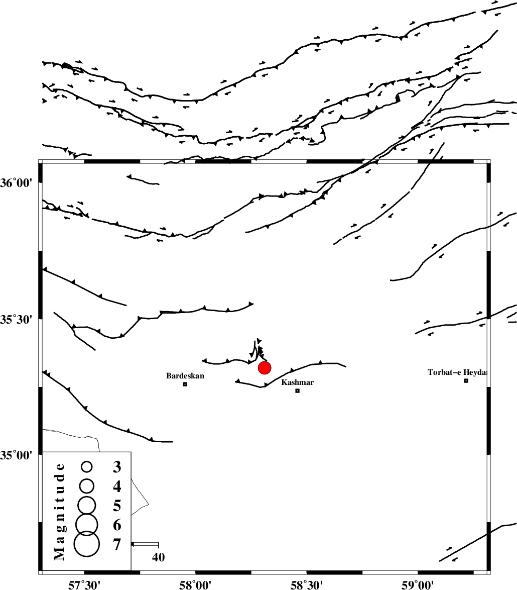
| Location | Lat:35.32 Lon: 58.31 |
| Region | Khorasan(center) Province, 16 km West of Kashmar |
Nearest Cities |
|
| 7 km North of Khalilabad, Khorasan(center) Province | |
| 12 km North West of Kasrineh, Khorasan(center) Province | |
| 16 km North West of Kashmar, Khorasan(center) Province | |
| 19 km South of Toroq, Khorasan(center) Province | |
| 21 km South West of Rivash, Khorasan(center) Province | |
| Depth | 14 km |
| Agency | |
Faults within 150 km: |
|
| KASHMAR_F (Length: 91 km) , Distance to epicenter: 12 km | |
| DORUNEH_F (Length: 713 km) , Distance to epicenter: 15 km | |
| BIJVARD_F (Length: 83 km) , Distance to epicenter: 24 km | |
| Number of Phases | 7 |
| RMS | 0.2 |
| Number of Stations | 5 |
| Error in Latitude | >1.7 km |
| Error in Longitude | 5.4 km |
| Error in Depth | 4.6 km |
Download waveform in seisan format
to download seisan software Click here
to access information about IIEES stations Click here
Amplitude | ||||||||
| UID | Agency | Station | Component | Amplitude | Period | Arrival Time | Proccessing Time | Signal Clip |
| 95611 | IIEES | YZKH | E | 77.4 | 0.68 | 2015-05-08 17:11:36 | 2015-05-08 06:31:00 | n |
Phase | ||||||||||||
| Agency | Station | Component | Phase Type | Phase Quality | First Motion | Observed Arrival Time | Time Residual | Loc. Flag | Input Weight | Distance | Azimuth | |
| IIEES | SHRO | Z | Pg | E | 2015-05-08 17:09:45 | -0.21 | y | 222 | 291 | |||
| IIEES | BJRD | Z | Pn | E | 2015-05-08 17:09:51 | 0.14 | y | 276 | 343 | |||
| IIEES | BJRD | E | Sg | E | 2015-05-08 17:10:27 | -0.09 | y | 276 | 343 | |||
| IIEES | MRVT | Z | Pn | E | 2015-05-08 17:09:58 | 0.21 | y | 327 | 323 | |||
| IIEES | BSRN | Z | Pn | E | 2015-05-08 17:10:04 | -0.33 | y | 379 | 168 | |||
| IIEES | BSRN | E | Sg | E | 2015-05-08 17:10:56 | 0.08 | y | 379 | 168 | |||
| IIEES | YZKH | Z | Pn | E | 2015-05-08 17:10:16 | 0.25 | y | 473 | 228 | |||