
Magnitude |
:3.1 |
| Date & Time (UTC) | 2015-05-08 16:09:15.3 |
| Date & Time (Local) | 1394/2/18 20:39:15.3 |
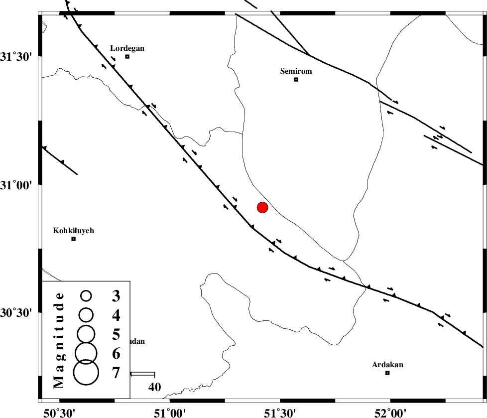
| Location | Lat:30.91 Lon: 51.42 |
| Region | Kohkiluieh va boyerahmad Province, 6 km Sisakht |
Nearest Cities |
|
| 6 km North of Sisakht, Kohkiluieh va boyerahmad Province | |
| 11 km North of Kerik, Kohkiluieh va boyerahmad Province | |
| 18 km North East of Chitab, Kohkiluieh va boyerahmad Province | |
| 24 km South West of Kameh, Esfahan Province | |
| 30 km South East of Meymand, Kohkiluieh va boyerahmad Province | |
| Depth | 18 km |
| Agency | |
Faults within 150 km: |
|
| DENA_F (Length: 137 km) , Distance to epicenter: 7 km | |
| HZF3 (Length: 197 km) , Distance to epicenter: 33 km | |
| KAZERUN_F (Length: 96 km) , Distance to epicenter: 47 km | |
| Number of Phases | 5 |
| RMS | 0 |
| Number of Stations | 4 |
| Error in Latitude | >1.7 km |
| Error in Longitude | 3.2 km |
| Error in Depth | 5.9 km |
Download waveform in seisan format
to download seisan software Click here
to access information about IIEES stations Click here
Amplitude | ||||||||
| UID | Agency | Station | Component | Amplitude | Period | Arrival Time | Proccessing Time | Signal Clip |
| 95607 | IIEES | NASN | E | 112.8 | 0.4 | 2015-05-08 16:10:28 | 2015-05-08 05:31:00 | n |
| 95608 | IIEES | NASN | N | 105.7 | 0.6 | 2015-05-08 16:10:31 | 2015-05-08 05:31:00 | n |
Phase | ||||||||||||
| Agency | Station | Component | Phase Type | Phase Quality | First Motion | Observed Arrival Time | Time Residual | Loc. Flag | Input Weight | Distance | Azimuth | |
| IIEES | AHRM | Z | Pn | E | 2015-05-08 16:09:50 | 0 | y | 227 | 183 | |||
| IIEES | AHRM | E | Sg | E | 2015-05-08 16:10:19 | 0 | y | 227 | 183 | |||
| IIEES | NASN | Z | Pn | E | 2015-05-08 16:09:53 | 0.02 | y | 247 | 32 | |||
| IIEES | KHMZ | Z | Pn | E | 2015-05-08 16:10:05 | -0.01 | y | 342 | 337 | |||
| IIEES | YZKH | Z | Pn | E | 2015-05-08 16:10:05 | -0.02 | y | 343 | 61 | |||