
Magnitude |
:4.2 |
| Date & Time (UTC) | 2015-05-08 00:25:01.5 |
| Date & Time (Local) | 1394/2/18 04:55:01.5 |
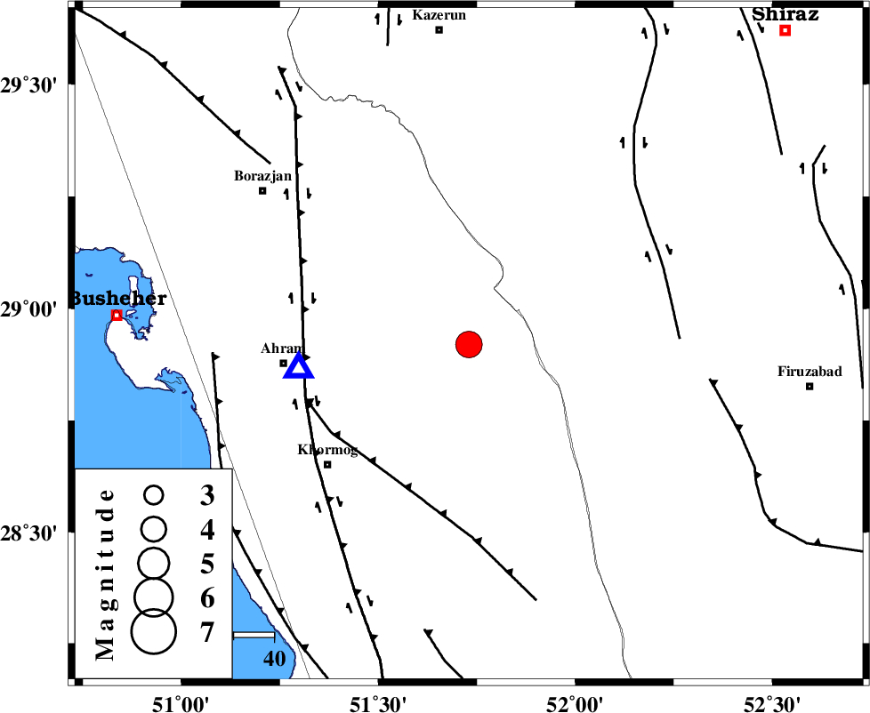
| Location | Lat:28.92 Lon: 51.73 |
| Region | Bushehr Province, 35 km West of Farashband |
Nearest Cities |
|
| 27 km East of Kalameh, Bushehr Province | |
| 32 km West of Aviz, Fars Province | |
| 34 km South West of Nujin, Fars Province | |
| 35 km North West of Farashband, Fars Province | |
| 43 km South West of Jareh, Fars Province | |
| Depth | 26 km |
| Agency | |
Faults within 150 km: |
|
| MFF5 (Length: 74 km) , Distance to epicenter: 38 km | |
| BORAZJAN_F (Length: 168 km) , Distance to epicenter: 41 km | |
| KAREBASS_F (Length: 98 km) , Distance to epicenter: 51 km | |
| Number of Phases | 9 |
| RMS | 0.1 |
| Number of Stations | 9 |
| Error in Latitude | >4.1 km |
| Error in Longitude | 4.2 km |
| Error in Depth | 6.7 km |
Download waveform in seisan format
to download seisan software Click here
to access information about IIEES stations Click here
Amplitude | ||||||||
| UID | Agency | Station | Component | Amplitude | Period | Arrival Time | Proccessing Time | Signal Clip |
| 95599 | IIEES | KRBR | N | 240.5 | 0.48 | 2015-05-08 00:27:11 | 2015-05-08 01:56:00 | n |
Phase | ||||||||||||
| Agency | Station | Component | Phase Type | Phase Quality | First Motion | Observed Arrival Time | Time Residual | Loc. Flag | Input Weight | Distance | Azimuth | |
| IIEES | AHRM | Z | Pg | E | 2015-05-08 00:25:09 | 0 | y | 42.4 | 263 | |||
| IIEES | BNDS | Z | Pn | E | 2015-05-08 00:26:06 | 0.01 | y | 468 | 110 | |||
| IIEES | YZKH | Z | Pn | E | 2015-05-08 00:26:07 | 0.11 | y | 473 | 35 | |||
| IIEES | KRBR | Z | Pn | E | 2015-05-08 00:26:10 | -0.03 | y | 502 | 75 | |||
| IIEES | KHMZ | Z | Pn | E | 2015-05-08 00:26:17 | 0.05 | y | 561 | 343 | |||
| IIEES | GHVR | Z | Pn | E | 2015-05-08 00:26:24 | -0.04 | y | 619 | 356 | |||
| IIEES | ASAO | Z | Pn | E | 2015-05-08 00:26:28 | -0.06 | y | 645 | 346 | |||
| IIEES | BSRN | Z | Pn | E | 2015-05-08 00:26:45 | -0.2 | y | 787 | 63 | |||
| IIEES | ZHSF | Z | Pn | E | 2015-05-08 00:26:57 | 0.13 | y | 883 | 83 | |||