
Magnitude |
:2.2 |
| Date & Time (UTC) | 2015-05-04 03:16:44.8 |
| Date & Time (Local) | 1394/2/14 07:46:44.8 |
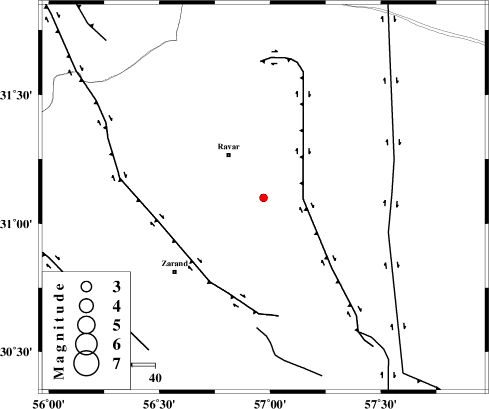
| Location | Lat:31.1 Lon: 56.97 |
| Region | Kerman Province, 24 km South-East of Ravar |
Nearest Cities |
|
| 24 km South East of Ravar, Kerman Province | |
| 30 km South East of Dehali, Kerman Province | |
| 33 km North East of Hatkan, Kerman Province | |
| 34 km North East of Ahmadi, Kerman Province | |
| 38 km North of Hejdak, Kerman Province | |
| Depth | 17 km |
| Agency | |
Faults within 150 km: |
|
| LAKARKUH_F (Length: 138 km) , Distance to epicenter: 17 km | |
| KUHBANAN_F (Length: 189 km) , Distance to epicenter: 43 km | |
| NAYBAND_F (Length: 258 km) , Distance to epicenter: 55 km | |
| Number of Phases | 4 |
| RMS | 0 |
| Number of Stations | 3 |
| Error in Latitude | >4.6 km |
| Error in Longitude | 2.6 km |
| Error in Depth | 12.3 km |
Download waveform in seisan format
to download seisan software Click here
to access information about IIEES stations Click here
Amplitude | ||||||||
| UID | Agency | Station | Component | Amplitude | Period | Arrival Time | Proccessing Time | Signal Clip |
| 95566 | IIEES | YZKH | N | 12.9 | 0.45 | 2015-05-04 03:18:03 | 2015-05-04 11:11:00 | n |
| 95567 | IIEES | YZKH | E | 14.7 | 0.51 | 2015-05-04 03:18:03 | 2015-05-04 11:11:00 | n |
Phase | ||||||||||||
| Agency | Station | Component | Phase Type | Phase Quality | First Motion | Observed Arrival Time | Time Residual | Loc. Flag | Input Weight | Distance | Azimuth | |
| IIEES | KRBR | Z | Pg | E | 2015-05-04 03:17:06 | 0 | y | 125 | 189 | |||
| IIEES | KRBR | N | Sg | E | 2015-05-04 03:17:21 | -0.01 | y | 125 | 189 | |||
| IIEES | BSRN | Z | Pn | E | 2015-05-04 03:17:20 | 0 | y | 226 | 64 | |||
| IIEES | YZKH | Z | Pn | E | 2015-05-04 03:17:25 | 0 | y | 267 | 303 | |||