
Magnitude |
:3 |
| Date & Time (UTC) | 2015-04-27 07:36:23.7 |
| Date & Time (Local) | 1394/2/7 12:06:23.7 |
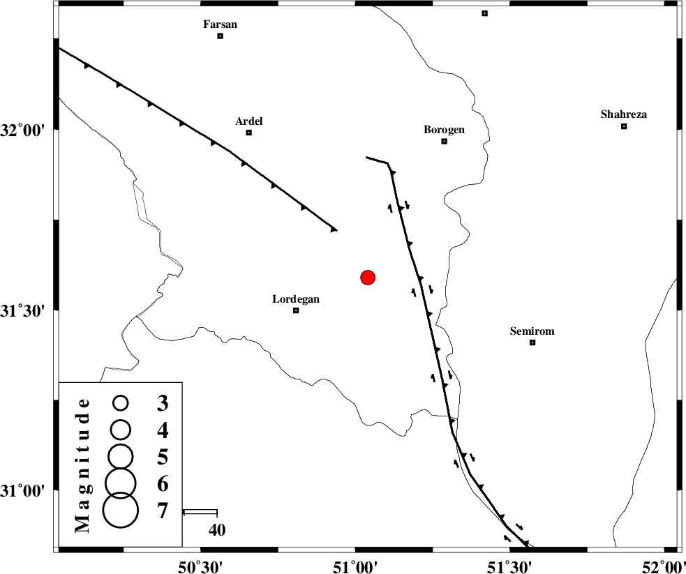
| Location | Lat:31.59 Lon: 51.04 |
| Region | Chaharmahal Bakhtiari Province, 24 km East of Lordegan |
Nearest Cities |
|
| 5 km North of Aluni, Chaharmahal Bakhtiari Province | |
| 24 km East of Armand-e olia, Chaharmahal Bakhtiari Province | |
| 24 km North East of Lordegan, Chaharmahal Bakhtiari Province | |
| 28 km North West of Vanak, Esfahan Province | |
| 30 km North East of Sardasht, Chaharmahal Bakhtiari Province | |
| Depth | 14 km |
| Agency | |
Faults within 150 km: |
|
| DOPOLAN_F (Length: 107 km) , Distance to epicenter: 9 km | |
| DENA_F (Length: 137 km) , Distance to epicenter: 15 km | |
| SABZKUH_F (Length: 67 km) , Distance to epicenter: 21 km | |
| Number of Phases | 6 |
| RMS | 0.2 |
| Number of Stations | 5 |
| Error in Latitude | >6.7 km |
| Error in Longitude | 2.1 km |
| Error in Depth | 4.3 km |
Download waveform in seisan format
to download seisan software Click here
to access information about IIEES stations Click here
Amplitude | ||||||||
| UID | Agency | Station | Component | Amplitude | Period | Arrival Time | Proccessing Time | Signal Clip |
| 95524 | IIEES | SHGR | N | 185.3 | 0.71 | 2015-04-27 07:37:37 | 2015-04-27 09:03:00 | n |
| 95525 | IIEES | SHGR | E | 208.9 | 0.56 | 2015-04-27 07:37:38 | 2015-04-27 09:03:00 | n |
| 95526 | IIEES | ASAO | N | 29.2 | 0.68 | 2015-04-27 07:38:05 | 2015-04-27 09:03:00 | n |
| 95527 | IIEES | ASAO | E | 19.8 | 0.89 | 2015-04-27 07:38:17 | 2015-04-27 09:03:00 | n |
Phase | ||||||||||||
| Agency | Station | Component | Phase Type | Phase Quality | First Motion | Observed Arrival Time | Time Residual | Loc. Flag | Input Weight | Distance | Azimuth | |
| IIEES | NASN | Z | P | E | 2015-04-27 07:36:58 | 0.03 | y | 214 | 51 | |||
| IIEES | SHGR | Z | Pg | E | 2015-04-27 07:36:59 | -0.25 | y | 220 | 286 | |||
| IIEES | SHGR | N | S | E | 2015-04-27 07:37:24 | 0.22 | y | 220 | 286 | |||
| IIEES | KHMZ | Z | Pn | E | 2015-04-27 07:37:03 | 0.14 | y | 259 | 337 | |||
| IIEES | ASAO | Z | Pn | E | 2015-04-27 07:37:13 | -0.21 | y | 342 | 344 | |||
| IIEES | YZKH | Z | Pn | E | 2015-04-27 07:37:14 | 0.05 | y | 347 | 74 | |||