
Magnitude |
:3.3 |
| Date & Time (UTC) | 2015-04-23 17:44:19.7 |
| Date & Time (Local) | 1394/2/3 22:14:19.7 |
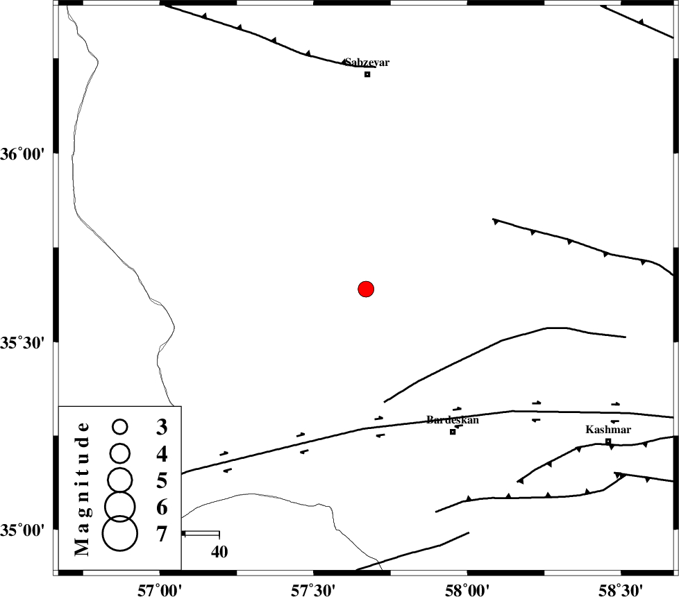
| Location | Lat:35.64 Lon: 57.67 |
| Region | Khorasan(center) Province, 63 km South of Sabzevar |
Nearest Cities |
|
| 18 km South of Bejdan, Khorasan(center) Province | |
| 21 km South West of Tondak, Khorasan(center) Province | |
| 37 km South of Sheshtamad, Khorasan(center) Province | |
| 40 km North West of Kabudan, Khorasan(center) Province | |
| 42 km West of Ghaleh meidan, Khorasan(center) Province | |
| Depth | 18 km |
| Agency | |
Faults within 150 km: |
|
| BIJVARD_F (Length: 83 km) , Distance to epicenter: 31 km | |
| DORUNEH_F (Length: 713 km) , Distance to epicenter: 41 km | |
| BALHAR_F (Length: 117 km) , Distance to epicenter: 43 km | |
| Number of Phases | 5 |
| RMS | 0.1 |
| Number of Stations | 4 |
| Error in Latitude | >2.6 km |
| Error in Longitude | 3.6 km |
| Error in Depth | 8.3 km |
Download waveform in seisan format
to download seisan software Click here
to access information about IIEES stations Click here
Amplitude | ||||||||
| UID | Agency | Station | Component | Amplitude | Period | Arrival Time | Proccessing Time | Signal Clip |
| 95508 | IIEES | SHRT | N | 70.7 | 0.44 | 2015-04-23 17:45:59 | 2015-04-23 06:14:00 | n |
| 95509 | IIEES | YZKH | E | 40.6 | 0.52 | 2015-04-23 17:46:42 | 2015-04-23 06:14:00 | n |
| 95510 | IIEES | YZKH | N | 36.9 | 0.48 | 2015-04-23 17:46:46 | 2015-04-23 06:14:00 | n |
Phase | ||||||||||||
| Agency | Station | Component | Phase Type | Phase Quality | First Motion | Observed Arrival Time | Time Residual | Loc. Flag | Input Weight | Distance | Azimuth | |
| IIEES | SHRO | Z | Pn | E | 2015-04-23 17:44:46 | -0.18 | y | 155 | 286 | |||
| IIEES | BJRD | N | Pn | E | 2015-04-23 17:44:55 | 0.07 | y | 230 | 354 | |||
| IIEES | BJRD | E | Sg | E | 2015-04-23 17:45:24 | 0.02 | y | 230 | 354 | |||
| IIEES | SHRT | Z | Pn | E | 2015-04-23 17:45:07 | -0.09 | y | 327 | 132 | |||
| IIEES | YZKH | Z | Pn | E | 2015-04-23 17:45:24 | 0.22 | y | 459 | 219 | |||