
Magnitude |
:2.8 |
| Date & Time (UTC) | 2015-04-23 14:46:25.9 |
| Date & Time (Local) | 1394/2/3 19:16:25.9 |
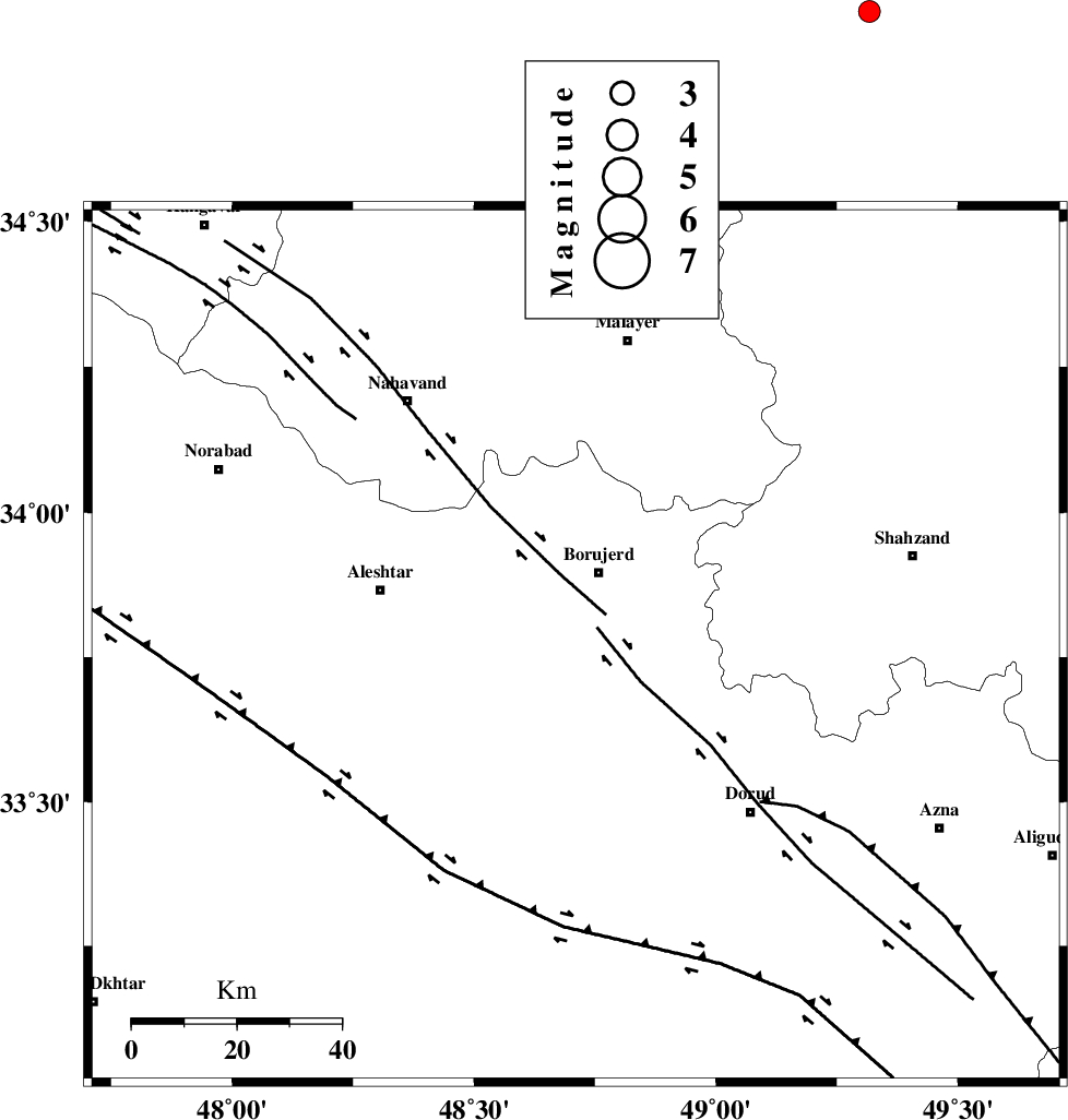
| Location | Lat:33.77 Lon: 48.71 |
| Region | Lorestan Province, 14 km South of Borujerd |
Nearest Cities |
|
| 6 km North of Pellekan-e sofla, Lorestan Province | |
| 11 km of Hemmatabad, Lorestan Province | |
| 15 km South of Borujerd, Lorestan Province | |
| 15 km West of Valanjerd, Lorestan Province | |
| 19 km North East of Cheharborji, Lorestan Province | |
| Depth | 15 km |
| Agency | |
Faults within 150 km: |
|
| DORUD (Length: 100 km) , Distance to epicenter: 5 km | |
| NAHAVAND_F (Length: 102 km) , Distance to epicenter: 8 km | |
| MAIN_ZAGROS_R_F (Length: 1106 km) , Distance to epicenter: 46 km | |
| Number of Phases | 3 |
| RMS | 0 |
| Number of Stations | 3 |
| Error in Latitude | >4.7 km |
| Error in Longitude | 2.4 km |
| Error in Depth | 0 km |
Download waveform in seisan format
to download seisan software Click here
to access information about IIEES stations Click here
Amplitude | ||||||||
| UID | Agency | Station | Component | Amplitude | Period | Arrival Time | Proccessing Time | Signal Clip |
| 95506 | IIEES | ASAO | N | 151.3 | 0.36 | 2015-04-23 14:47:11 | 2015-04-23 03:02:00 | n |
| 95507 | IIEES | ASAO | E | 155.3 | 0.4 | 2015-04-23 14:47:11 | 2015-04-23 03:02:00 | n |
Phase | ||||||||||||
| Agency | Station | Component | Phase Type | Phase Quality | First Motion | Observed Arrival Time | Time Residual | Loc. Flag | Input Weight | Distance | Azimuth | |
| IIEES | KHMZ | Z | Pg | E | 2015-04-23 14:46:45 | -0.01 | y | 116 | 91 | |||
| IIEES | ASAO | Z | Pg | E | 2015-04-23 14:46:50 | 0 | y | 148 | 54 | |||
| IIEES | SNGE | Z | Pn | E | 2015-04-23 14:46:57 | 0.01 | y | 193 | 320 | |||