
Magnitude |
:3.1 |
| Date & Time (UTC) | 2015-04-19 13:02:30.4 |
| Date & Time (Local) | 1394/1/30 17:32:30.4 |
| Location | Lat:30.71 Lon: 50.31 |
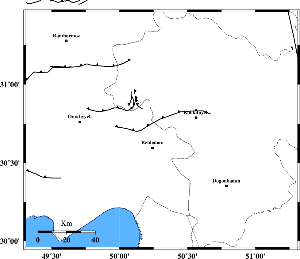
| Region | Khoozestan Province, 14 km North of Behbahan |
Nearest Cities |
|
| 9 km North of Mansuriyeh, Khoozestan Province | |
| 12 km East of Dodange-ye bozorg, Khoozestan Province | |
| 14 km North of Behbahan, Khoozestan Province | |
| 26 km West of Dehdasht, Kohkiluieh va boyerahmad Province | |
| 32 km South West of Lendeh, Kohkiluieh va boyerahmad Province | |
| Depth | 14 km |
| Agency | |
Faults within 150 km: |
|
| MFF4 (Length: 62 km) , Distance to epicenter: 10 km | |
| MISHAN_F (Length: 76 km) , Distance to epicenter: 37 km | |
| AGHAJARI_F (Length: 88 km) , Distance to epicenter: 43 km | |
| Number of Phases | 6 |
| RMS | 0.1 |
| Number of Stations | 5 |
| Error in Latitude | >2 km |
| Error in Longitude | 3.6 km |
| Error in Depth | 7 km |
Download waveform in seisan format
to download seisan software Click here
to access information about IIEES stations Click here
Amplitude | ||||||||
| UID | Agency | Station | Component | Amplitude | Period | Arrival Time | Proccessing Time | Signal Clip |
| 95465 | IIEES | SHGR | N | 157.4 | 0.52 | 2015-04-19 13:03:36 | 2015-04-19 03:29:00 | n |
| 95466 | IIEES | SHGR | E | 167.9 | 0.68 | 2015-04-19 13:03:40 | 2015-04-19 03:29:00 | n |
Phase | ||||||||||||
| Agency | Station | Component | Phase Type | Phase Quality | First Motion | Observed Arrival Time | Time Residual | Loc. Flag | Input Weight | Distance | Azimuth | |
| IIEES | SHGR | Z | Pn | E | 2015-04-19 13:03:04 | 0.08 | y | 211 | 318 | |||
| IIEES | AHRM | Z | Pn | E | 2015-04-19 13:03:06 | 0.04 | y | 226 | 155 | |||
| IIEES | AHRM | E | Sg | E | 2015-04-19 13:03:34 | -0.04 | y | 226 | 155 | |||
| IIEES | NASN | Z | Pn | E | 2015-04-19 13:03:19 | 0.09 | y | 331 | 45 | |||
| IIEES | KHMZ | Z | Pn | E | 2015-04-19 13:03:20 | -0.18 | y | 337 | 355 | |||
| IIEES | ASAO | Z | Pn | E | 2015-04-19 13:03:31 | 0 | y | 426 | 356 | |||