
Magnitude |
:2.8 |
| Date & Time (UTC) | 2015-04-12 20:15:30.6 |
| Date & Time (Local) | 1394/1/24 00:45:30.6 |
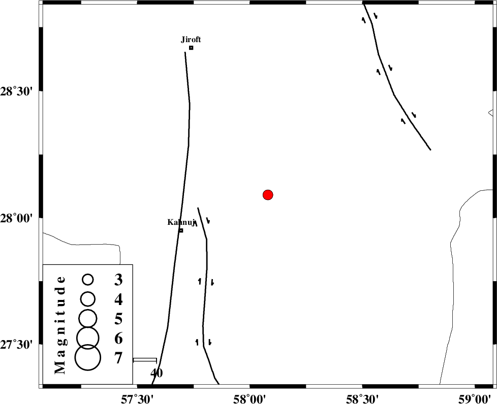
| Location | Lat:28.09 Lon: 58.08 |
| Region | Kerman Province, 41 km North-East of Kahnuj |
Nearest Cities |
|
| 30 km South of Mardehak, Kerman Province | |
| 39 km South East of Dosari, Kerman Province | |
| 41 km North East of Kahnuj, Kerman Province | |
| 43 km North West of Borj-e abbasabad, Kerman Province | |
| 44 km South East of Aliabad-e qadiri, Kerman Province | |
| Depth | 15 km |
| Agency | |
Faults within 150 km: |
|
| JIROFT_F (Length: 144 km) , Distance to epicenter: 31 km | |
| SABZEVARAN_F (Length: 190 km) , Distance to epicenter: 38 km | |
| BAM_F (Length: 118 km) , Distance to epicenter: 70 km | |
| Number of Phases | 5 |
| RMS | 0.1 |
| Number of Stations | 4 |
| Error in Latitude | >3.4 km |
| Error in Longitude | 4.7 km |
| Error in Depth | 8.4 km |
Download waveform in seisan format
to download seisan software Click here
to access information about IIEES stations Click here
Amplitude | ||||||||
| UID | Agency | Station | Component | Amplitude | Period | Arrival Time | Proccessing Time | Signal Clip |
| 95422 | IIEES | KRBR | E | 33.8 | 0.36 | 2015-04-12 20:16:42 | 2015-04-12 09:04:00 | n |
| 95423 | IIEES | KRBR | N | 26.6 | 0.2 | 2015-04-12 20:16:45 | 2015-04-12 09:04:00 | n |
| 95424 | IIEES | CHBR | E | 98.4 | 0.36 | 2015-04-12 20:17:01 | 2015-04-12 09:04:00 | n |
Phase | ||||||||||||
| Agency | Station | Component | Phase Type | Phase Quality | First Motion | Observed Arrival Time | Time Residual | Loc. Flag | Input Weight | Distance | Azimuth | |
| IIEES | KRBR | Z | Pn | E | 2015-04-12 20:16:09 | 0.1 | y | 246 | 329 | |||
| IIEES | KRBR | E | Sg | E | 2015-04-12 20:16:40 | 0 | y | 246 | 329 | |||
| IIEES | ZHSF | Z | Pn | E | 2015-04-12 20:16:17 | 0.16 | y | 312 | 57 | |||
| IIEES | CHBR | Z | Pn | E | 2015-04-12 20:16:23 | -0.05 | y | 365 | 139 | |||
| IIEES | BSRN | Z | Pn | E | 2015-04-12 20:16:32 | -0.27 | y | 441 | 13 | |||