
Magnitude |
:3.7 |
| Date & Time (UTC) | 2015-04-10 10:13:46.3 |
| Date & Time (Local) | 1394/1/21 14:43:46.3 |
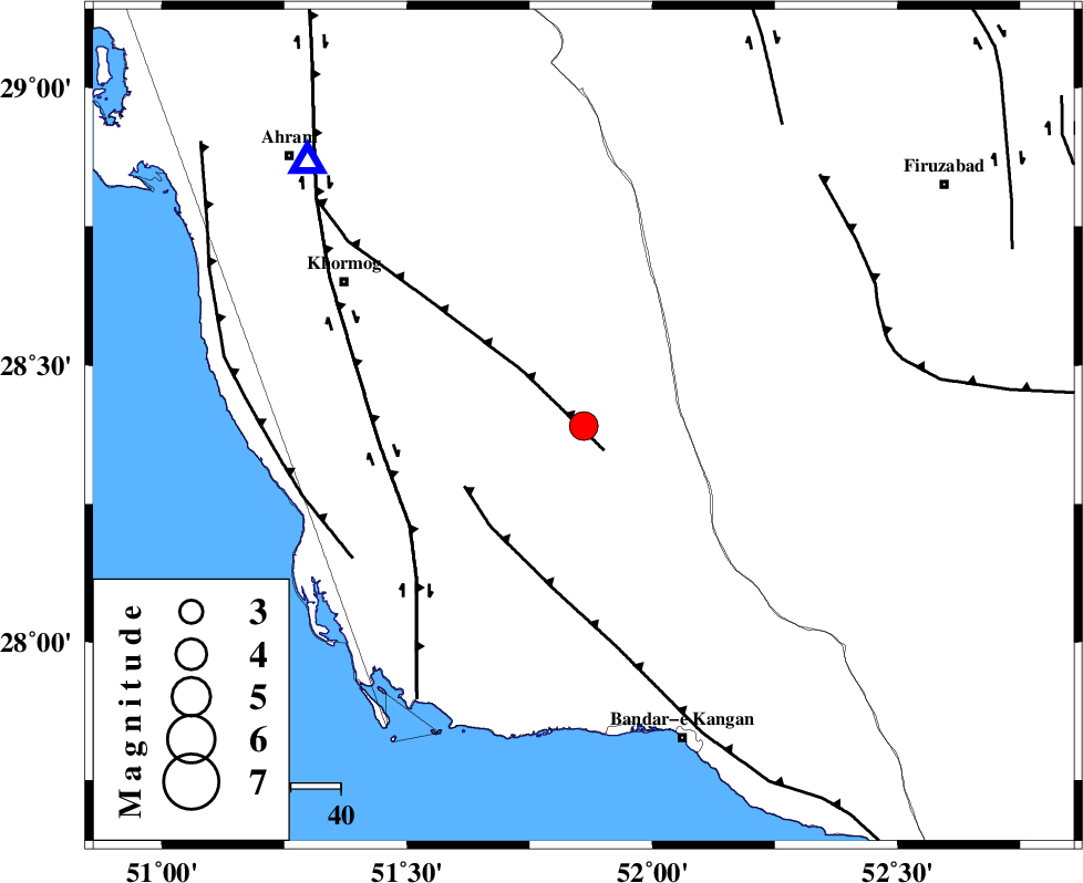
| Location | Lat:28.39 Lon: 51.86 |
| Region | Bushehr Province, 58 km South-West of Farashband |
Nearest Cities |
|
| 10 km of Shanbeh, Bushehr Province | |
| 34 km North East of Kaki, Bushehr Province | |
| 36 km East of Baduleh, Bushehr Province | |
| 36 km North East of Abdan, Bushehr Province | |
| 41 km North East of Abkesh, Bushehr Province | |
| Depth | 15 km |
| Agency | |
Faults within 150 km: |
|
| MFF5 (Length: 74 km) , Distance to epicenter: 6 km | |
| MFF3 (Length: 292 km) , Distance to epicenter: 27 km | |
| BORAZJAN_F (Length: 168 km) , Distance to epicenter: 40 km | |
| Number of Phases | 6 |
| RMS | 0 |
| Number of Stations | 5 |
| Error in Latitude | >2.8 km |
| Error in Longitude | 2.3 km |
| Error in Depth | 5.5 km |
Download waveform in seisan format
to download seisan software Click here
to access information about IIEES stations Click here
Amplitude | ||||||||
| UID | Agency | Station | Component | Amplitude | Period | Arrival Time | Proccessing Time | Signal Clip |
| 95386 | IIEES | SHGR | E | 64.5 | 0.56 | 2015-04-10 10:16:33 | 2015-04-10 10:46:00 | n |
Phase | ||||||||||||
| Agency | Station | Component | Phase Type | Phase Quality | First Motion | Observed Arrival Time | Time Residual | Loc. Flag | Input Weight | Distance | Azimuth | |
| IIEES | AHRM | Z | Pg | E | 2015-04-10 10:13:59 | 0.01 | y | 75.9 | 314 | |||
| IIEES | AHRM | N | Sg | E | 2015-04-10 10:14:08 | -0.01 | y | 75.9 | 314 | |||
| IIEES | NASN | Z | Pn | E | 2015-04-10 10:14:56 | 0.04 | y | 497 | 10 | |||
| IIEES | NASN | E | Sg | E | 2015-04-10 10:16:05 | 0 | y | 497 | 10 | |||
| IIEES | KRBR | Z | Pn | E | 2015-04-10 10:14:57 | 0 | y | 509 | 69 | |||
| IIEES | YZKH | Z | Pn | E | 2015-04-10 10:14:58 | -0.04 | y | 516 | 30 | |||