
Magnitude |
:2.9 |
| Date & Time (UTC) | 2015-04-02 21:09:54.3 |
| Date & Time (Local) | 1394/1/14 01:39:54.3 |
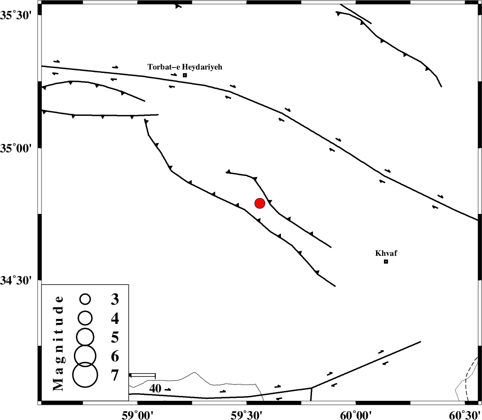
| Location | Lat:34.79 Lon: 59.56 |
| Region | Khorasan(center) Province, 58 km North-West of Khaf |
Nearest Cities |
|
| 22 km South of Hoseynabad, Khorasan(center) Province | |
| 23 km West of Chamanabad, Khorasan(center) Province | |
| 25 km South of Rashtkhvar, Khorasan(center) Province | |
| 33 km North East of Jangal, Khorasan(center) Province | |
| 35 km South East of Basfar, Khorasan(center) Province | |
| Depth | 15 km |
| Agency | |
Faults within 150 km: |
|
| KHAF_F (Length: 58 km) , Distance to epicenter: 5 km | |
| JANGAL_F (Length: 111 km) , Distance to epicenter: 7 km | |
| DORUNEH_F (Length: 713 km) , Distance to epicenter: 39 km | |
| Number of Phases | 4 |
| RMS | 0.1 |
| Number of Stations | 4 |
| Error in Latitude | >4.2 km |
| Error in Longitude | 1.7 km |
| Error in Depth | 0 km |
Download waveform in seisan format
to download seisan software Click here
to access information about IIEES stations Click here
Amplitude | ||||||||
| UID | Agency | Station | Component | Amplitude | Period | Arrival Time | Proccessing Time | Signal Clip |
| 95315 | IIEES | SHRT | E | 199.6 | 0.12 | 2015-04-02 21:10:42 | 2015-04-02 11:37:00 | n |
| 95316 | IIEES | SHRT | N | 210.9 | 0.32 | 2015-04-02 21:10:43 | 2015-04-02 11:37:00 | n |
Phase | ||||||||||||
| Agency | Station | Component | Phase Type | Phase Quality | First Motion | Observed Arrival Time | Time Residual | Loc. Flag | Input Weight | Distance | Azimuth | |
| IIEES | SHRT | Z | Pn | E | 2015-04-02 21:10:19 | -0.07 | y | 144 | 152 | |||
| IIEES | BSRN | Z | Pn | E | 2015-04-02 21:10:41 | 0.15 | y | 316 | 187 | |||
| IIEES | SHRO | Z | Pn | E | 2015-04-02 21:10:45 | 0.05 | y | 349 | 294 | |||
| IIEES | YZKH | Z | Pn | E | 2015-04-02 21:11:08 | -0.17 | y | 533 | 241 | |||