
Magnitude |
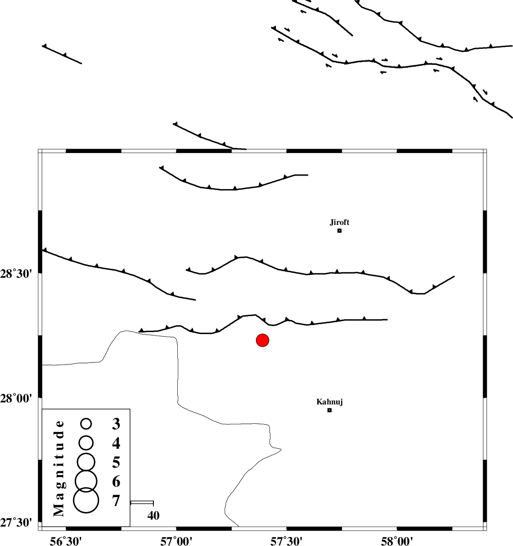
:3.7 |
| Date & Time (UTC) | 2015-03-23 02:20:34.6 |
| Date & Time (Local) | 1394/1/3 06:50:34.6 |
| Location | Lat:28.23 Lon: 57.39 |
| Region | Kerman Province, 44 km North-West of Kahnuj |
Nearest Cities |
|
| 8 km North of Hurpasefid, Kerman Province | |
| 16 km North West of Bolock, Kerman Province | |
| 16 km North of Mehrueye-e paeen, Kerman Province | |
| 22 km North East of Faryab, Kerman Province | |
| 43 km North West of Kahnuj, Kerman Province | |
| Depth | 14 km |
| Agency | |
Faults within 150 km: |
|
| SABZEVARAN_F (Length: 190 km) , Distance to epicenter: 34 km | |
| JIROFT_F (Length: 144 km) , Distance to epicenter: 43 km | |
| MAIN_ZAGROS_R_F (Length: 1106 km) , Distance to epicenter: 58 km | |
| Number of Phases | 6 |
| RMS | 0.1 |
| Number of Stations | 4 |
| Error in Latitude | >3.4 km |
| Error in Longitude | 2.4 km |
| Error in Depth | 7.6 km |
Download waveform in seisan format
to download seisan software Click here
to access information about IIEES stations Click here
Amplitude | ||||||||
| UID | Agency | Station | Component | Amplitude | Period | Arrival Time | Proccessing Time | Signal Clip |
| 95281 | IIEES | KRBR | E | 633.4 | 0.44 | 2015-03-23 02:21:41 | 2015-03-23 02:46:00 | n |
| 95282 | IIEES | KRBR | N | 621.2 | 0.4 | 2015-03-23 02:21:41 | 2015-03-23 02:46:00 | n |
Phase | ||||||||||||
| Agency | Station | Component | Phase Type | Phase Quality | First Motion | Observed Arrival Time | Time Residual | Loc. Flag | Input Weight | Distance | Azimuth | |
| IIEES | KRBR | Z | Pn | E | 2015-03-23 02:21:07 | 0.17 | y | 203 | 343 | |||
| IIEES | KRBR | E | Sg | E | 2015-03-23 02:21:32 | -0.13 | y | 203 | 343 | |||
| IIEES | ZHSF | Z | Pn | E | 2015-03-23 02:21:27 | -0.16 | y | 364 | 64 | |||
| IIEES | ZHSF | N | Sg | E | 2015-03-23 02:22:16 | 0.13 | y | 364 | 64 | |||
| IIEES | CHBR | Z | Pn | E | 2015-03-23 02:21:34 | -0.11 | y | 424 | 133 | |||
| IIEES | AHRM | Z | Pn | E | 2015-03-23 02:21:56 | 0.13 | y | 600 | 278 | |||