
Magnitude |
:3.3 |
| Date & Time (UTC) | 2015-03-21 04:35:58.7 |
| Date & Time (Local) | 1394/1/1 08:05:58.7 |
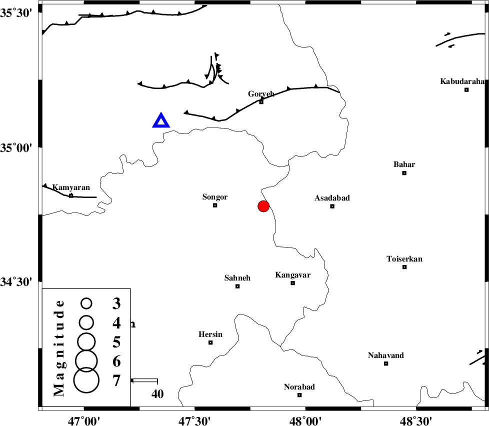
| Location | Lat:34.78 Lon: 47.81 |
| Region | Kermanshah Province, 20 km East of Sonqor |
Nearest Cities |
|
| 6 km North of Ajin, Hamedan Province | |
| 7 km of Abbarik-e olia, Kermanshah Province | |
| 10 km of Abbarik-e sofla, Kermanshah Province | |
| 11 km North of Farsinaj, Kermanshah Province | |
| 15 km South East of Bavoleh, Kermanshah Province | |
| Depth | 14 km |
| Agency | |
Faults within 150 km: |
|
| DINEHVAR_F (Length: 46 km) , Distance to epicenter: 31 km | |
| SAHANEH_F (Length: 77 km) , Distance to epicenter: 33 km | |
| SARTAKHT_F (Length: 78 km) , Distance to epicenter: 35 km | |
| Number of Phases | 4 |
| RMS | 0.1 |
| Number of Stations | 4 |
| Error in Latitude | >4.9 km |
| Error in Longitude | 3.2 km |
| Error in Depth | 6.6 km |
Download waveform in seisan format
to download seisan software Click here
to access information about IIEES stations Click here
Amplitude | ||||||||
| UID | Agency | Station | Component | Amplitude | Period | Arrival Time | Proccessing Time | Signal Clip |
| 95278 | IIEES | SHGR | E | 112.2 | 0.44 | 2015-03-21 04:37:29 | 2015-03-21 05:39:00 | n |
Phase | ||||||||||||
| Agency | Station | Component | Phase Type | Phase Quality | First Motion | Observed Arrival Time | Time Residual | Loc. Flag | Input Weight | Distance | Azimuth | |
| IIEES | SNGE | Z | Pg | E | 2015-03-21 04:36:08 | -0.02 | y | 54.4 | 310 | |||
| IIEES | ASAO | Z | Pg | E | 2015-03-21 04:36:32 | -0.16 | y | 205 | 97 | |||
| IIEES | SHGR | N | Pn | E | 2015-03-21 04:36:44 | -0.01 | y | 310 | 162 | |||
| IIEES | GHVR | Z | Pn | E | 2015-03-21 04:36:46 | 0.21 | y | 317 | 95 | |||