
Magnitude |
:1.6 |
| Date & Time (UTC) | 2015-03-16 19:43:40.2 |
| Date & Time (Local) | 1393/12/25 23:13:40.2 |
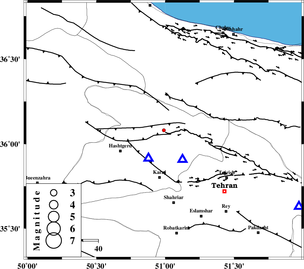
| Location | Lat:36.08 Lon: 50.99 |
| Region | Tehran Province, 31 km North of Karaj |
Nearest Cities |
|
| 16 km North of Barghan, Tehran Province | |
| 21 km North East of Chandar, Tehran Province | |
| 24 km South East of Shahrak, Tehran Province | |
| 31 km South East of Taleqan, Tehran Province | |
| 31 km North of Karaj, Tehran Province | |
| Depth | 10 km |
| Agency | |
Faults within 150 km: |
|
| MOSHA_F (Length: 234 km) , Distance to epicenter: 3 km | |
| TALEGHAN_F (Length: 71 km) , Distance to epicenter: 5 km | |
| ALAMUTRUD_F (Length: 140 km) , Distance to epicenter: 14 km | |
| Number of Phases | 5 |
| RMS | 0.2 |
| Number of Stations | 4 |
| Error in Latitude | >6.2 km |
| Error in Longitude | 3.3 km |
| Error in Depth | 4.2 km |
Download waveform in seisan format
to download seisan software Click here
to access information about IIEES stations Click here
Amplitude | ||||||||
| UID | Agency | Station | Component | Amplitude | Period | Arrival Time | Proccessing Time | Signal Clip |
| 95247 | IIEES | DAMV | E | 18 | 0.12 | 2015-03-16 19:44:12 | 2015-03-17 02:44:00 | n |
Phase | ||||||||||||
| Agency | Station | Component | Phase Type | Phase Quality | First Motion | Observed Arrival Time | Time Residual | Loc. Flag | Input Weight | Distance | Azimuth | |
| IIEES | THKV | Z | Pg | E | 2015-03-16 19:43:44 | 0.11 | y | 20.4 | 209 | |||
| IIEES | CHTH | Z | Pg | E | 2015-03-16 19:43:44 | -0.32 | y | 22.3 | 147 | |||
| IIEES | CHTH | E | Sg | E | 2015-03-16 19:43:48 | 0.07 | y | 22.3 | 147 | |||
| IIEES | DAMV | Z | Pg | E | 2015-03-16 19:43:58 | 0.16 | y | 101 | 119 | |||
| IIEES | ASAO | Z | Pn | E | 2015-03-16 19:44:12 | -0.03 | y | 191 | 208 | |||