
Magnitude |
:2.8 |
| Date & Time (UTC) | 2015-03-06 08:59:52.7 |
| Date & Time (Local) | 1393/12/15 12:29:52.7 |
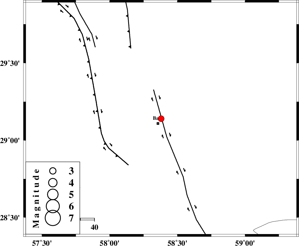
| Location | Lat:29.14 Lon: 58.38 |
| Region | Kerman Province, 4 km Bam |
Nearest Cities |
|
| 2 km North of Poshtrud, Kerman Province | |
| 4 km North of Bam, Kerman Province | |
| 10 km North of Baravat, Kerman Province | |
| 31 km North West of Abshur-e nezamabad, Kerman Province | |
| 32 km North West of Qasemabad, Kerman Province | |
| Depth | 14 km |
| Agency | |
Faults within 150 km: |
|
| BAM_F (Length: 118 km) , Distance to epicenter: 14 km | |
| GOWK_F (Length: 152 km) , Distance to epicenter: 41 km | |
| SHAHDAD_F (Length: 108 km) , Distance to epicenter: 55 km | |
| Number of Phases | 5 |
| RMS | 0.2 |
| Number of Stations | 3 |
| Error in Latitude | >4 km |
| Error in Longitude | 3 km |
| Error in Depth | 8.7 km |
Download waveform in seisan format
to download seisan software Click here
to access information about IIEES stations Click here
Amplitude | ||||||||
| UID | Agency | Station | Component | Amplitude | Period | Arrival Time | Proccessing Time | Signal Clip |
| 95181 | IIEES | KRBR | N | 112.7 | 0.52 | 2015-03-06 09:00:46 | 2015-03-06 09:25:00 | n |
Phase | ||||||||||||
| Agency | Station | Component | Phase Type | Phase Quality | First Motion | Observed Arrival Time | Time Residual | Loc. Flag | Input Weight | Distance | Azimuth | |
| IIEES | KRBR | Z | Pg | E | 2015-03-06 09:00:22 | -0.03 | y | 182 | 301 | |||
| IIEES | KRBR | N | Sg | E | 2015-03-06 09:00:44 | -0.04 | y | 182 | 301 | |||
| IIEES | ZHSF | Z | Pn | E | 2015-03-06 09:00:30 | -0.13 | y | 239 | 77 | |||
| IIEES | BSRN | Z | Pn | E | 2015-03-06 09:00:40 | 0.31 | y | 322 | 13 | |||
| IIEES | BSRN | E | Sg | E | 2015-03-06 09:01:22 | -0.09 | y | 322 | 13 | |||