
Magnitude |
:3.3 |
| Date & Time (UTC) | 2015-03-06 08:49:55.0 |
| Date & Time (Local) | 1393/12/15 12:19:55.0 |
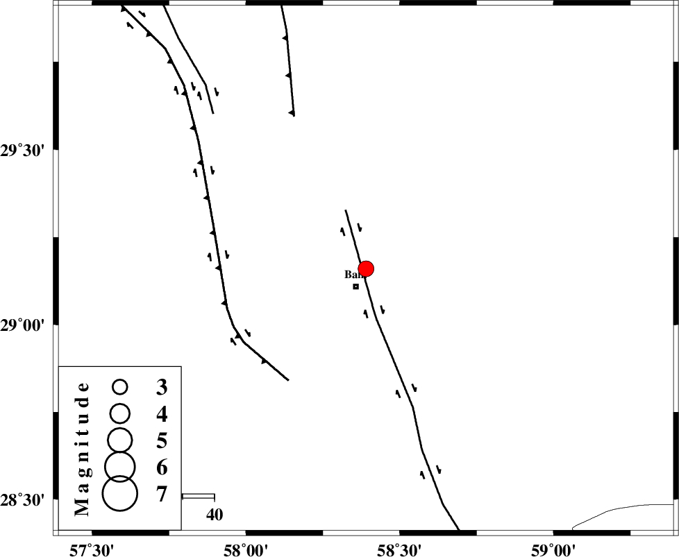
| Location | Lat:29.16 Lon: 58.39 |
| Region | Kerman Province, 7 km Bam |
Nearest Cities |
|
| 4 km North of Poshtrud, Kerman Province | |
| 7 km North of Bam, Kerman Province | |
| 12 km North of Baravat, Kerman Province | |
| 32 km North West of Abshur-e nezamabad, Kerman Province | |
| 33 km North West of Qasemabad, Kerman Province | |
| Depth | 14 km |
| Agency | |
Faults within 150 km: |
|
| BAM_F (Length: 118 km) , Distance to epicenter: 16 km | |
| GOWK_F (Length: 152 km) , Distance to epicenter: 43 km | |
| SHAHDAD_F (Length: 108 km) , Distance to epicenter: 53 km | |
| Number of Phases | 6 |
| RMS | 0.1 |
| Number of Stations | 4 |
| Error in Latitude | >2.5 km |
| Error in Longitude | 2.1 km |
| Error in Depth | 6.2 km |
Download waveform in seisan format
to download seisan software Click here
to access information about IIEES stations Click here
Amplitude | ||||||||
| UID | Agency | Station | Component | Amplitude | Period | Arrival Time | Proccessing Time | Signal Clip |
| 95179 | IIEES | KRBR | E | 449.6 | 0.24 | 2015-03-06 08:50:48 | 2015-03-06 09:10:00 | n |
| 95180 | IIEES | BSRN | E | 70.4 | 0.48 | 2015-03-06 08:51:28 | 2015-03-06 09:10:00 | n |
Phase | ||||||||||||
| Agency | Station | Component | Phase Type | Phase Quality | First Motion | Observed Arrival Time | Time Residual | Loc. Flag | Input Weight | Distance | Azimuth | |
| IIEES | KRBR | Z | Pg | E | 2015-03-06 08:50:25 | 0.04 | y | 183 | 300 | |||
| IIEES | KRBR | N | Sg | E | 2015-03-06 08:50:47 | -0.03 | y | 183 | 300 | |||
| IIEES | ZHSF | Z | Pn | E | 2015-03-06 08:50:32 | -0.03 | y | 237 | 77 | |||
| IIEES | BNDS | Z | Pn | E | 2015-03-06 08:50:39 | -0.05 | y | 292 | 229 | |||
| IIEES | BSRN | Z | Pn | E | 2015-03-06 08:50:42 | 0.15 | y | 319 | 13 | |||
| IIEES | BSRN | E | Sg | E | 2015-03-06 08:51:24 | -0.08 | y | 319 | 13 | |||