
Magnitude |
:3.2 |
| Date & Time (UTC) | 2015-03-05 10:28:14.6 |
| Date & Time (Local) | 1393/12/14 13:58:14.6 |
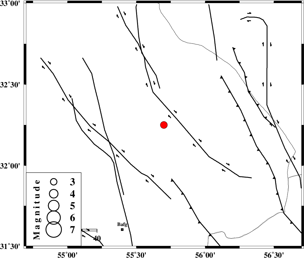
| Location | Lat:32.25 Lon: 55.7 |
| Region | Yazd Province, 78 km North-East of Bafq |
Nearest Cities |
|
| 52 km North West of Behabad, Yazd Province | |
| 57 km North of Kushk, Yazd Province | |
| 68 km North West of Benestan, Yazd Province | |
| 74 km North East of Mobarake, Yazd Province | |
| 77 km North East of Bafq, Yazd Province | |
| Depth | 14 km |
| Agency | |
Faults within 150 km: |
|
| SARBALA_F (Length: 92 km) , Distance to epicenter: 11 km | |
| JAFARABAD_F (Length: 60 km) , Distance to epicenter: 24 km | |
| KUHBANAN_F (Length: 189 km) , Distance to epicenter: 29 km | |
| Number of Phases | 6 |
| RMS | 0.1 |
| Number of Stations | 4 |
| Error in Latitude | >2.7 km |
| Error in Longitude | 2.5 km |
| Error in Depth | 4.5 km |
Download waveform in seisan format
to download seisan software Click here
to access information about IIEES stations Click here
Amplitude | ||||||||
| UID | Agency | Station | Component | Amplitude | Period | Arrival Time | Proccessing Time | Signal Clip |
| 95169 | IIEES | KRBR | N | 124.5 | 0.84 | 2015-03-05 10:29:35 | 2015-03-05 10:46:00 | n |
Phase | ||||||||||||
| Agency | Station | Component | Phase Type | Phase Quality | First Motion | Observed Arrival Time | Time Residual | Loc. Flag | Input Weight | Distance | Azimuth | |
| IIEES | YZKH | Z | Pg | E | 2015-03-05 10:28:32 | 0.13 | y | 105 | 279 | |||
| IIEES | YZKH | N | Sg | E | 2015-03-05 10:28:45 | -0.11 | y | 105 | 279 | |||
| IIEES | KRBR | Z | Pn | E | 2015-03-05 10:28:56 | 0.08 | y | 272 | 158 | |||
| IIEES | KRBR | N | Sg | E | 2015-03-05 10:29:31 | -0.03 | y | 272 | 158 | |||
| IIEES | NASN | Z | Pn | E | 2015-03-05 10:28:57 | 0.01 | y | 278 | 283 | |||
| IIEES | BSRN | Z | Pn | E | 2015-03-05 10:29:02 | -0.1 | y | 325 | 95 | |||