
Magnitude |
:2.5 |
| Date & Time (UTC) | 2015-02-11 15:33:39.7 |
| Date & Time (Local) | 1393/11/22 19:03:39.7 |
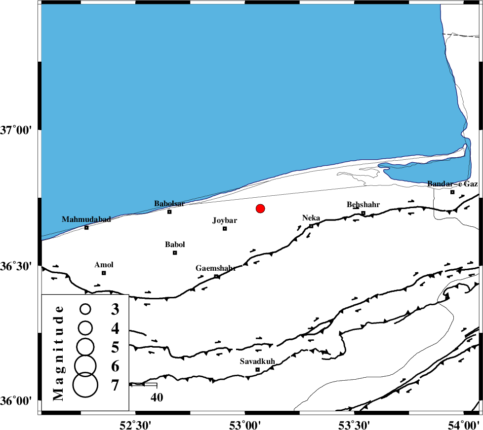
| Location | Lat:36.71 Lon: 53.07 |
| Region | Mazandaran Province, 17 km North of Sari |
Nearest Cities |
|
| 9 km of Farahabad, Mazandaran Province | |
| 12 km East of Larim, Mazandaran Province | |
| 12 km North East of Kuhikhel, Mazandaran Province | |
| 15 km North East of Gelird, Mazandaran Province | |
| 16 km North West of Tuska, Mazandaran Province | |
| Depth | 14 km |
| Agency | |
Faults within 150 km: |
|
| KHAZAR_F (Length: 523 km) , Distance to epicenter: 20 km | |
| N_ALBORZ_F (Length: 360 km) , Distance to epicenter: 53 km | |
| DAMGHAN_F (Length: 95 km) , Distance to epicenter: 93 km | |
| Number of Phases | 5 |
| RMS | 0.1 |
| Number of Stations | 3 |
| Error in Latitude | >4.8 km |
| Error in Longitude | 4.3 km |
| Error in Depth | 6.2 km |
Download waveform in seisan format
to download seisan software Click here
to access information about IIEES stations Click here
Amplitude | ||||||||
| UID | Agency | Station | Component | Amplitude | Period | Arrival Time | Proccessing Time | Signal Clip |
| 95021 | IIEES | THKV | N | 40.6 | 0.32 | 2015-02-11 15:34:46 | 2015-02-11 04:00:00 | n |
Phase | ||||||||||||
| Agency | Station | Component | Phase Type | Phase Quality | First Motion | Observed Arrival Time | Time Residual | Loc. Flag | Input Weight | Distance | Azimuth | |
| IIEES | DAMV | Z | Pg | E | 2015-02-11 15:34:05 | -0.1 | y | 155 | 220 | |||
| IIEES | DAMV | E | Sg | E | 2015-02-11 15:34:24 | 0.06 | y | 155 | 220 | |||
| IIEES | CHTH | Z | Pn | E | 2015-02-11 15:34:11 | 0 | y | 196 | 244 | |||
| IIEES | CHTH | N | Sg | E | 2015-02-11 15:34:35 | -0.04 | y | 196 | 244 | |||
| IIEES | THKV | Z | Pn | E | 2015-02-11 15:34:14 | 0.08 | y | 215 | 246 | |||