
Magnitude |
:3.4 |
| Date & Time (UTC) | 2015-02-08 19:41:40.5 |
| Date & Time (Local) | 1393/11/19 23:11:40.5 |
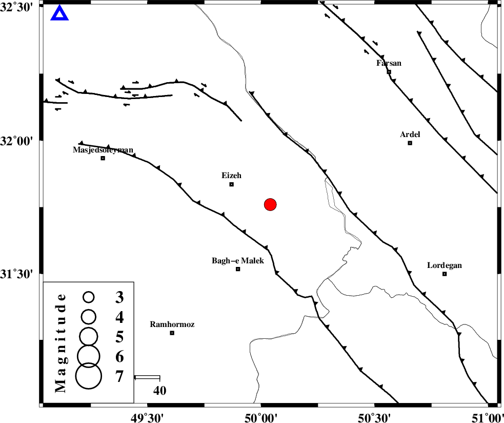
| Location | Lat:31.76 Lon: 50.04 |
| Region | Khoozestan Province, 18 km East of Izeh |
Nearest Cities |
|
| 18 km East of Izeh, Khoozestan Province | |
| 20 km North East of Ghaleh tal, Khoozestan Province | |
| 22 km North West of Dehdez, Khoozestan Province | |
| 24 km North of Abolabbas, Khoozestan Province | |
| 25 km South East of Rasvand, Khoozestan Province | |
| Depth | 15 km |
| Agency | |
Faults within 150 km: |
|
| MFF2 (Length: 205 km) , Distance to epicenter: 15 km | |
| DOPOLAN_F (Length: 107 km) , Distance to epicenter: 31 km | |
| SABZKUH_F (Length: 67 km) , Distance to epicenter: 31 km | |
| Number of Phases | 7 |
| RMS | 0.1 |
| Number of Stations | 6 |
| Error in Latitude | >3.8 km |
| Error in Longitude | 2.4 km |
| Error in Depth | 5.3 km |
Download waveform in seisan format
to download seisan software Click here
to access information about IIEES stations Click here
Amplitude | ||||||||
| UID | Agency | Station | Component | Amplitude | Period | Arrival Time | Proccessing Time | Signal Clip |
| 94992 | IIEES | GHVR | N | 99.8 | 0.76 | 2015-02-08 19:43:18 | 2015-02-08 08:05:00 | n |
| 94993 | IIEES | AHRM | N | 106.7 | 0.6 | 2015-02-08 19:43:26 | 2015-02-08 08:05:00 | n |
| 94994 | IIEES | AHRM | E | 118 | 0.6 | 2015-02-08 19:43:28 | 2015-02-08 08:05:00 | n |
Phase | ||||||||||||
| Agency | Station | Component | Phase Type | Phase Quality | First Motion | Observed Arrival Time | Time Residual | Loc. Flag | Input Weight | Distance | Azimuth | |
| IIEES | KHMZ | Z | Pn | E | 2015-02-08 19:42:15 | -0.11 | y | 220 | 358 | |||
| IIEES | NASN | Z | Pn | E | 2015-02-08 19:42:23 | -0.01 | y | 285 | 65 | |||
| IIEES | NASN | N | S | E | 2015-02-08 19:42:55 | -0.01 | y | 285 | 65 | |||
| IIEES | ASAO | Z | Pn | E | 2015-02-08 19:42:26 | 0.14 | y | 309 | 360 | |||
| IIEES | ASAO | E | Sg | E | 2015-02-08 19:43:07 | -0.02 | y | 309 | 360 | |||
| IIEES | GHVR | E | Sg | E | 2015-02-08 19:43:10 | -0.09 | y | 322 | 20 | |||
| IIEES | DAMV | E | Sg | E | 2015-02-08 19:43:50 | 0.13 | y | 465 | 22 | |||