
Magnitude |
:3.4 |
| Date & Time (UTC) | 2015-02-06 02:19:37.6 |
| Date & Time (Local) | 1393/11/17 05:49:37.6 |
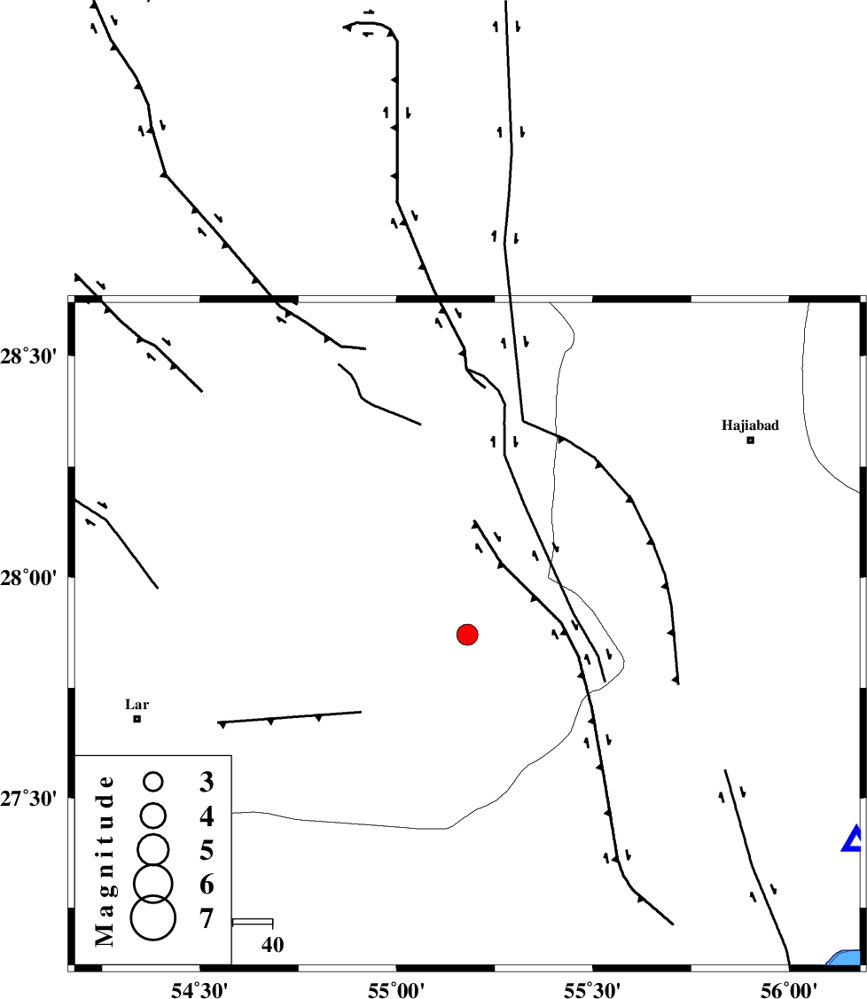
| Location | Lat:27.87 Lon: 55.18 |
| Region | Fars Province, 86 km North-East of Lar |
Nearest Cities |
|
| 24 km North West of Darz, Fars Province | |
| 37 km South of Fadami, Fars Province | |
| 49 km South of Doborji, Fars Province | |
| 65 km South East of Rostaq, Fars Province | |
| 74 km North East of Dehkuyeh, Fars Province | |
| Depth | 37 km |
| Agency | |
Faults within 150 km: |
|
| HZF2 (Length: 437 km) , Distance to epicenter: 42 km | |
| LAR_F (Length: 99 km) , Distance to epicenter: 45 km | |
| HZF1 (Length: 102 km) , Distance to epicenter: 59 km | |
| Number of Phases | 6 |
| RMS | 0.2 |
| Number of Stations | 6 |
| Error in Latitude | >5.7 km |
| Error in Longitude | 6.9 km |
| Error in Depth | 6.5 km |
Download waveform in seisan format
to download seisan software Click here
to access information about IIEES stations Click here
Amplitude | ||||||||
| UID | Agency | Station | Component | Amplitude | Period | Arrival Time | Proccessing Time | Signal Clip |
| 94975 | IIEES | KRBR | E | 163.7 | 0.48 | 2015-02-06 02:21:03 | 2015-02-06 02:48:00 | n |
Phase | ||||||||||||
| Agency | Station | Component | Phase Type | Phase Quality | First Motion | Observed Arrival Time | Time Residual | Loc. Flag | Input Weight | Distance | Azimuth | |
| IIEES | BNDS | Z | Pg | E | 2015-02-06 02:19:56 | 0 | y | 111 | 118 | |||
| IIEES | KRBR | Z | Pn | E | 2015-02-06 02:20:18 | -0.15 | y | 280 | 33 | |||
| IIEES | YZKH | Z | Pn | E | 2015-02-06 02:20:45 | -0.2 | y | 504 | 354 | |||
| IIEES | CHBR | Z | Pn | E | 2015-02-06 02:20:55 | -0.03 | y | 585 | 114 | |||
| IIEES | BSRN | Z | Pn | E | 2015-02-06 02:20:57 | 0.33 | y | 592 | 39 | |||
| IIEES | NASN | Z | Pn | E | 2015-02-06 02:20:57 | 0.19 | y | 592 | 338 | |||