
Magnitude |
:3.6 |
| Date & Time (UTC) | 2015-02-05 17:02:05.5 |
| Date & Time (Local) | 1393/11/16 20:32:05.5 |
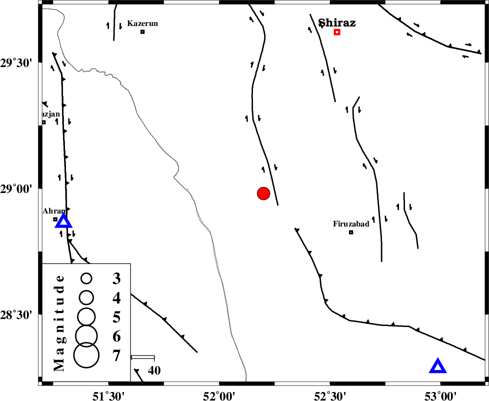
| Location | Lat:28.98 Lon: 52.2 |
| Region | Fars Province, 16 km North-East of Farashband |
Nearest Cities |
|
| 15 km South of Dadanjan, Fars Province | |
| 16 km North East of Aviz, Fars Province | |
| 16 km North East of Farashband, Fars Province | |
| 24 km South East of Nujin, Fars Province | |
| 35 km South East of Jareh, Fars Province | |
| Depth | 6 km |
| Agency | |
Faults within 150 km: |
|
| KAREBASS_F (Length: 98 km) , Distance to epicenter: 7 km | |
| QIR_F (Length: 130 km) , Distance to epicenter: 21 km | |
| SABZ_PUSHAN_F_Z1 (Length: 69 km) , Distance to epicenter: 47 km | |
| Number of Phases | 7 |
| RMS | 0.1 |
| Number of Stations | 5 |
| Error in Latitude | >6 km |
| Error in Longitude | 2.4 km |
| Error in Depth | 9.6 km |
Download waveform in seisan format
to download seisan software Click here
to access information about IIEES stations Click here
Amplitude | ||||||||
| UID | Agency | Station | Component | Amplitude | Period | Arrival Time | Proccessing Time | Signal Clip |
| 94972 | IIEES | AHRM | N | 2308.7 | 0.76 | 2015-02-05 17:02:43 | 2015-02-05 05:37:00 | n |
Phase | ||||||||||||
| Agency | Station | Component | Phase Type | Phase Quality | First Motion | Observed Arrival Time | Time Residual | Loc. Flag | Input Weight | Distance | Azimuth | |
| IIEES | AHRM | Z | Pg | E | 2015-02-05 17:02:20 | -0.02 | y | 88.5 | 262 | |||
| IIEES | AHRM | E | Sg | E | 2015-02-05 17:02:32 | 0.03 | y | 88.5 | 262 | |||
| IIEES | NASN | Z | Pn | E | 2015-02-05 17:03:07 | -0.1 | y | 428 | 8 | |||
| IIEES | NASN | N | Sn | 2015-02-05 17:03:52 | 0.08 | y | 428 | 8 | ||||
| IIEES | YZKH | Z | Pn | E | 2015-02-05 17:03:09 | -0.1 | y | 442 | 31 | |||
| IIEES | KRBR | Z | Pn | E | 2015-02-05 17:03:11 | -0.02 | y | 456 | 75 | |||
| IIEES | BSRN | Z | Pn | E | 2015-02-05 17:03:46 | 0.23 | y | 743 | 62 | |||