
Magnitude |
:2.8 |
| Date & Time (UTC) | 2015-02-01 08:39:48.9 |
| Date & Time (Local) | 1393/11/12 12:09:48.9 |
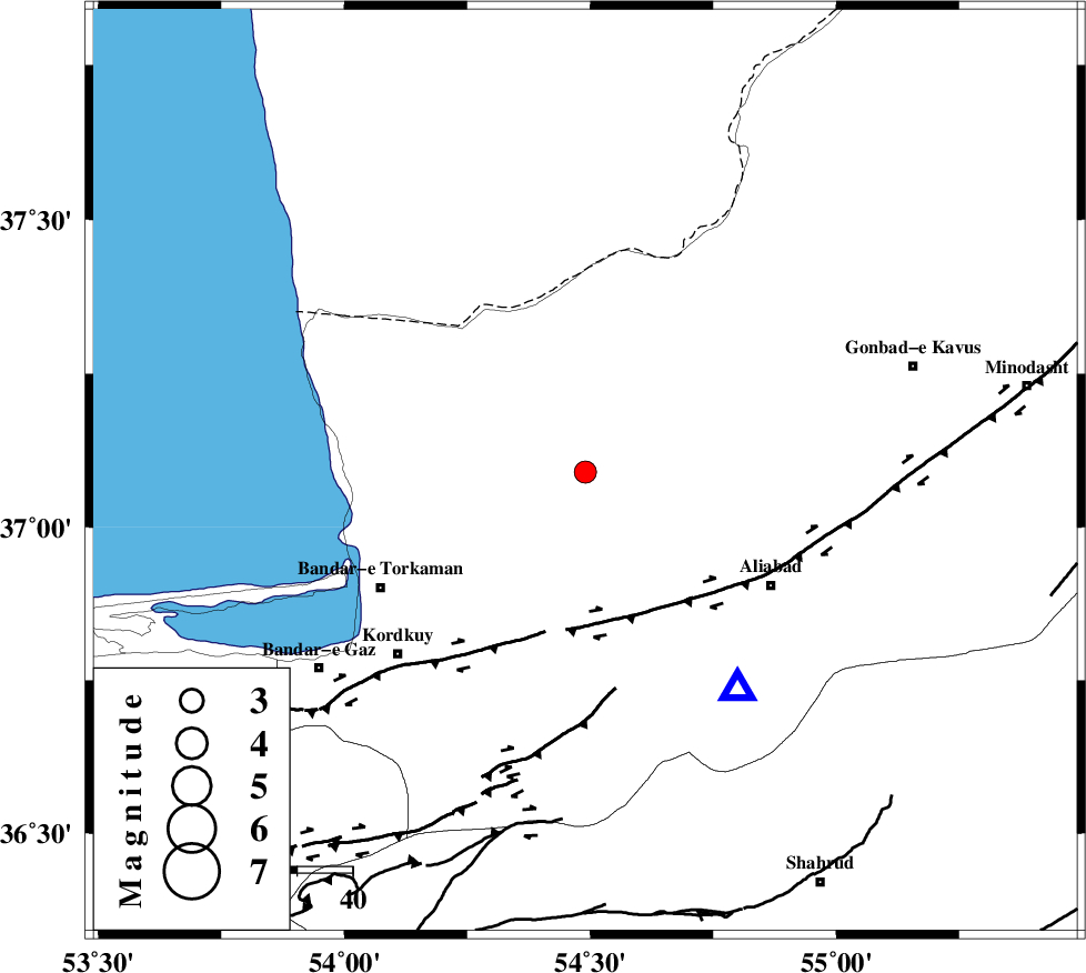
| Location | Lat:37.09 Lon: 54.49 |
| Region | Golestan Province, 10 km Aq Qaleh |
Nearest Cities |
|
| 9 km North of Qanqarmeh, Golestan Province | |
| 9 km North of Aq Qaleh, Golestan Province | |
| 15 km North of Nodeh malek, Golestan Province | |
| 22 km North West of Gariduji, Golestan Province | |
| 25 km North East of Banavar, Golestan Province | |
| Depth | 15 km |
| Agency | |
Faults within 150 km: |
|
| KHAZAR_F (Length: 523 km) , Distance to epicenter: 26 km | |
| N_ALBORZ_F (Length: 360 km) , Distance to epicenter: 54 km | |
| SHAVAR_F (Length: 87 km) , Distance to epicenter: 59 km | |
| Number of Phases | 6 |
| RMS | 0.2 |
| Number of Stations | 6 |
| Error in Latitude | >11.1 km |
| Error in Longitude | 1.5 km |
| Error in Depth | 0 km |
Download waveform in seisan format
to download seisan software Click here
to access information about IIEES stations Click here
Amplitude | ||||||||
| UID | Agency | Station | Component | Amplitude | Period | Arrival Time | Proccessing Time | Signal Clip |
| 94917 | IIEES | DAMV | E | 43 | 0.18 | 2015-02-01 08:41:17 | 2015-02-01 10:33:00 | n |
Phase | ||||||||||||
| Agency | Station | Component | Phase Type | Phase Quality | First Motion | Observed Arrival Time | Time Residual | Loc. Flag | Input Weight | Distance | Azimuth | |
| IIEES | DAMV | Z | Pn | E | 2015-02-01 08:40:31 | -0.02 | y | 278 | 235 | |||
| IIEES | CHTH | Z | Pn | E | 2015-02-01 08:40:37 | 0.01 | y | 329 | 247 | |||
| IIEES | TABS | Z | Pn | E | 2015-02-01 08:40:52 | 0.24 | y | 451 | 147 | |||
| IIEES | YZKH | Z | Pn | E | 2015-02-01 08:41:01 | 0.05 | y | 522 | 179 | |||
| IIEES | BSRN | Z | Pn | E | 2015-02-01 08:41:24 | -0.27 | y | 710 | 142 | |||
| IIEES | KRBR | Z | Pn | E | 2015-02-01 08:41:37 | -0.25 | y | 816 | 164 | |||